- Scattered rain and snow showers develop mid-morning.
- Icy conditions are possible Friday morning, followed by more snow.
- Dry and mild into next week.
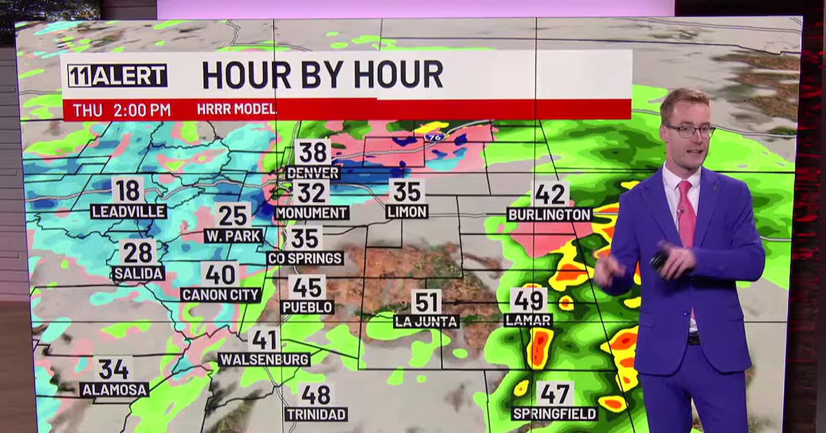
THURSDAY: Rain and snow showers move through this morning and remain scattered this afternoon and early evening. Most of the snow will melt as temperatures reach the 40s and 50s. Light accumulations are possible. Thunderstorms develop over the eastern Plains this afternoon.
FRIDAY: If roads are still wet Thursday night, we could see some icy roads again Friday morning. New snow showers develop around lunchtime and continue throughout the day. Heavy snow is possible over the southern I-25 corridor with strong northerly winds kicking in. This could cause reduced visibility when snow is falling. Impacts to the evening commute are likely! Temperatures remain cool in the 30s and 40s.
WEEKEND: Snow tapers off Saturday afternoon with highs in the 30s. Sunday will be drier and sunnier with quickly increasing temperatures.
NEXT WEEK: Lots of sunshine and milder, highs rising into the 60s and 70s!
Copyright 2025 KKTV. All rights reserved.