HOUSTON — The National Weather Service has issued a Severe Thunderstorm Warning for several counties in the Houston area, as strong storms continue to track through the region.
The warning covers northeastern Harris, southeastern Montgomery, southeastern San Jacinto, Liberty, and southeastern Polk counties and remains in effect until 10:45 a.m.
At 9:38 a.m., a cluster of strong to severe thunderstorms was located 8 miles east of Shepherd, or 15 miles south of Livingston, moving northeast at 40 mph.
- Hazard: Wind gusts up to 60 mph
- Source: Radar indicated
- Impact: Possible damage to roofs, siding, and trees
The following locations may experience severe weather:
- Cleveland, Woodbranch, North Cleveland, Moss Hill, and Hardin
- Splendora, Kingwood, Porter, Romayor, Kenefick, and Daisetta
- Goodrich, Rye, Shepherd, and New Caney
- Dayton Lakes, Tarkington Prairie, Segno, and Alabama-Coushatta Reservation


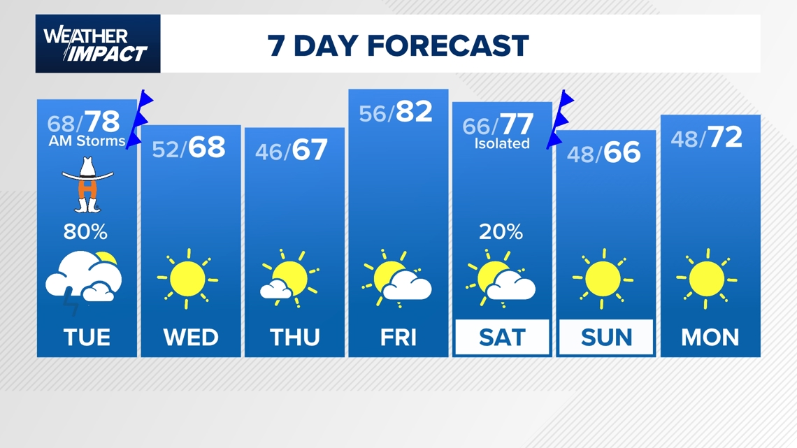
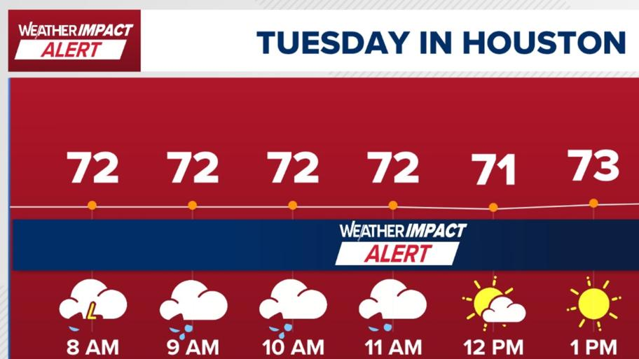
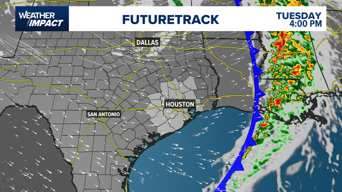
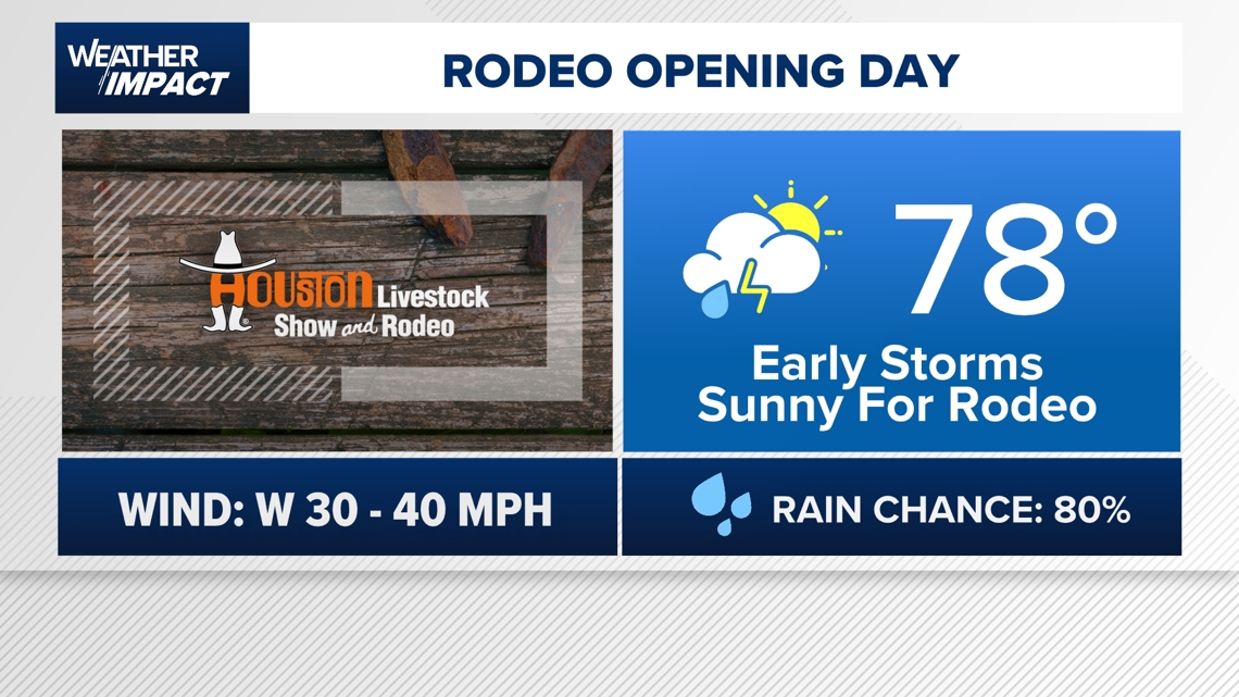
The KHOU 11 Weather Team has issued a Weather Impact Alert for Tuesday, March 4, 2025, from now through 2 p.m. Expect passing rain with gusty storms as the cold front moves through the Houston area. Winds could gust from 35-40 mph in some locations.

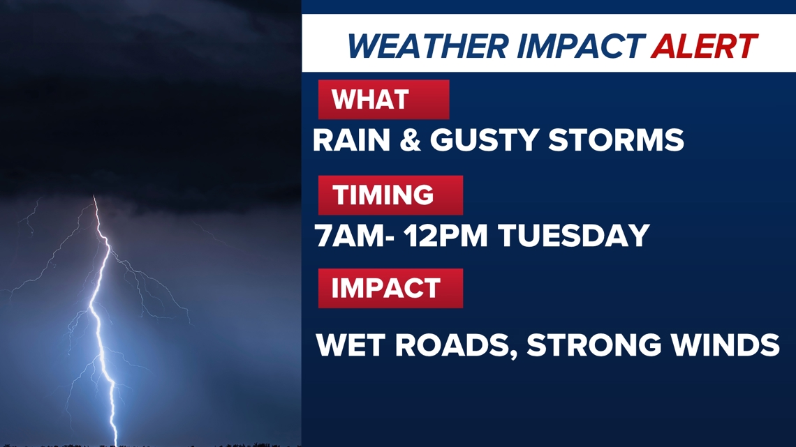
By 1 p.m. Tuesday, rain and storms will have raced off to the east, with rain ending for the day. Winds could still be breezy, gusting out of the northeast at 25-20 mph.

Good news! No, weather conditions should not impact concertgoers as the Houston Rodeo kicks off. Rain chances will be out of the picture by the concert’s start time. Winds could still be breezy gusting up to 25-30 mph. You might want to bring a light jacket as temperatures will be falling into the low 60s by the time the concert ends.

Tuesday’s cold front will bring overnight and morning temperatures back into the 40s and 50s for Wednesday and Thursday morning. Afternoons will be sunny with highs in the 60s and 70s. Weather models are hinting at another cold front that could keep morning temperatures chilly through the weekend.