DES MOINES, Iowa — Many ingredients are coming together for severe weather in Iowa on Monday. There are a couple of things in question, including how far south into the state these storms will develop and track. Below, the severe weather outlook areas from the Storm Prediction Center and Colorado State University’s severe weather algorithm.


My guess is that these areas will be trimmed farther to the north Sunday morning. Below, wind gusts and direction late Monday afternoon. Southwesterly winds are not ideal for tornado development, but things may change.

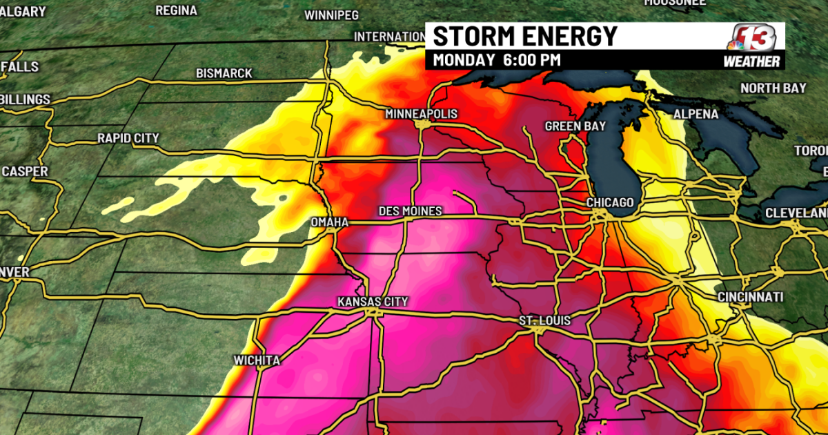
Notice dewpoints rising on Monday as these winds drag dewpoints in the 60-degree range into Iowa. The following storm energy graphic combines these dewpoints and temperatures in the 80s to measure the fuel that will be available for thunderstorms, which will be more than adequate.


Below, the forecast surface map for 7 p.m. Monday. A pair of cold fronts will be approaching from the northwest, acting as lifting mechanisms to help storms to form.

Below, the supercell composite index at the same time, combining the fuel mentioned above with wind shear (changing wind direction with height). Again, this outlook is favorable, although the best parameters may be in place out ahead of the approaching fronts.

Below, a frame grab from the HRRR short-range computer model at 7 p.m. Monday, showing strong storms developing in northwest Iowa near Orange City and Le Mars.

What we are still looking into: how far south into Iowa will the storms develop/progress and will the wind shear be sufficient to produce tornadoes as opposed to storms producing strong straight-line winds and hail. I’m not completely sold on severe chances south of Highway 20 yet. We’ll know more during the next 24 hours.
Copyright 2025 Nexstar Media Inc. All rights reserved. This material may not be published, broadcast, rewritten, or redistributed.