INDIANAPOLIS —
Weather Impact Alert: Tuesday
An incoming cold front will serve as the primary focus for showers and thunderstorms today, including the potential of strong to severe storms this afternoon into the early evening.
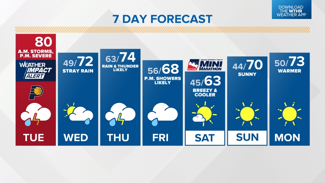
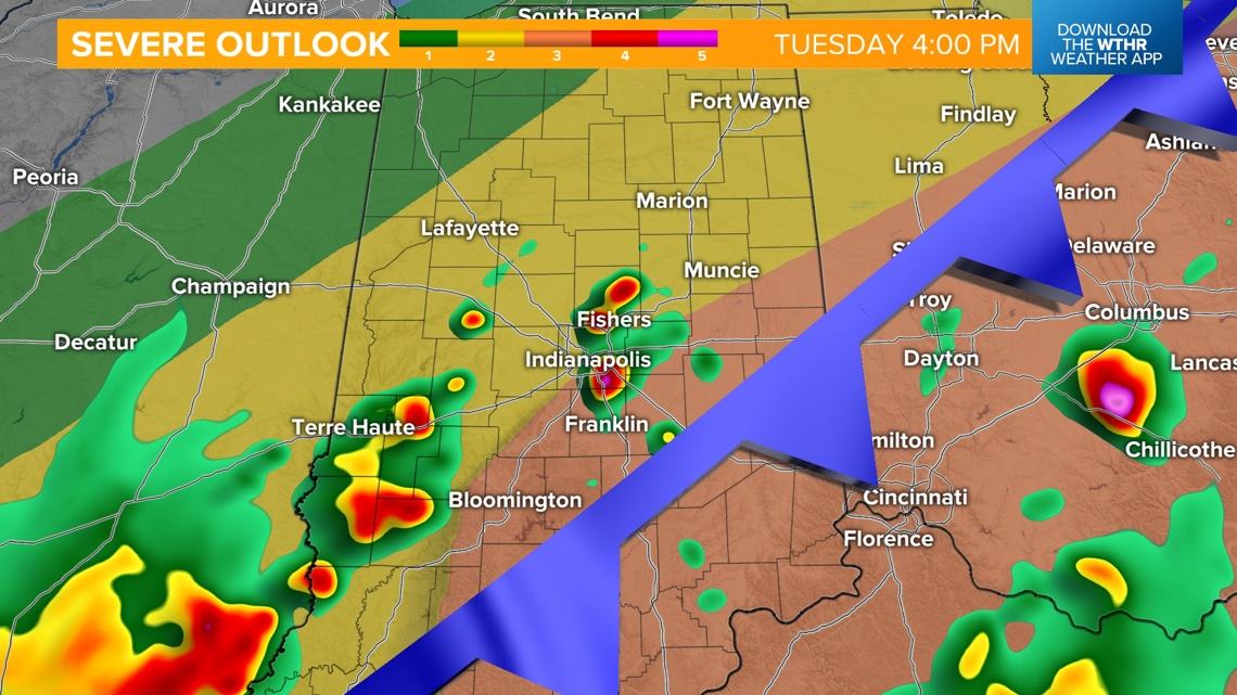
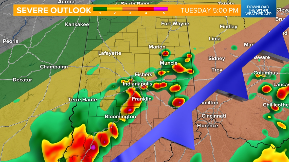
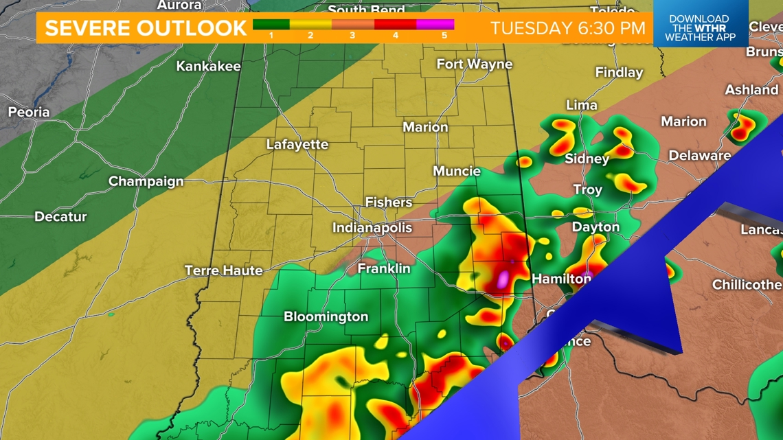
One round of likely non-severe storms will move through this morning. We’ll then see a lull in rain/storm activity with temperatures recovering to near 80 ahead of round 2 initiating between 3-4 p.m.

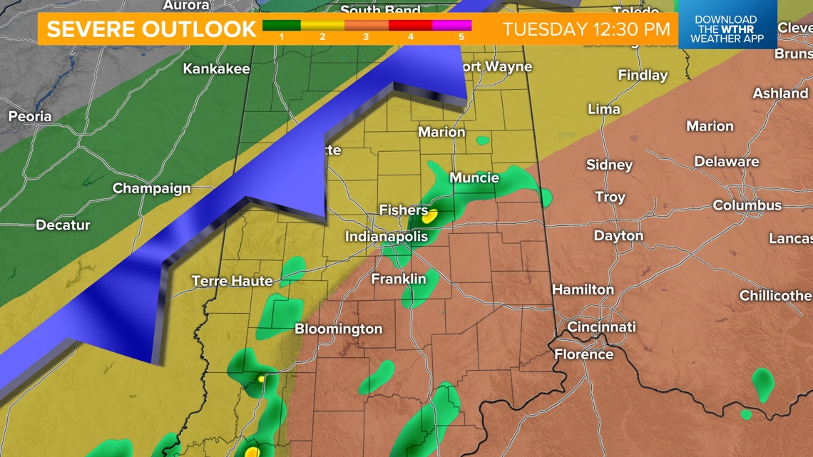
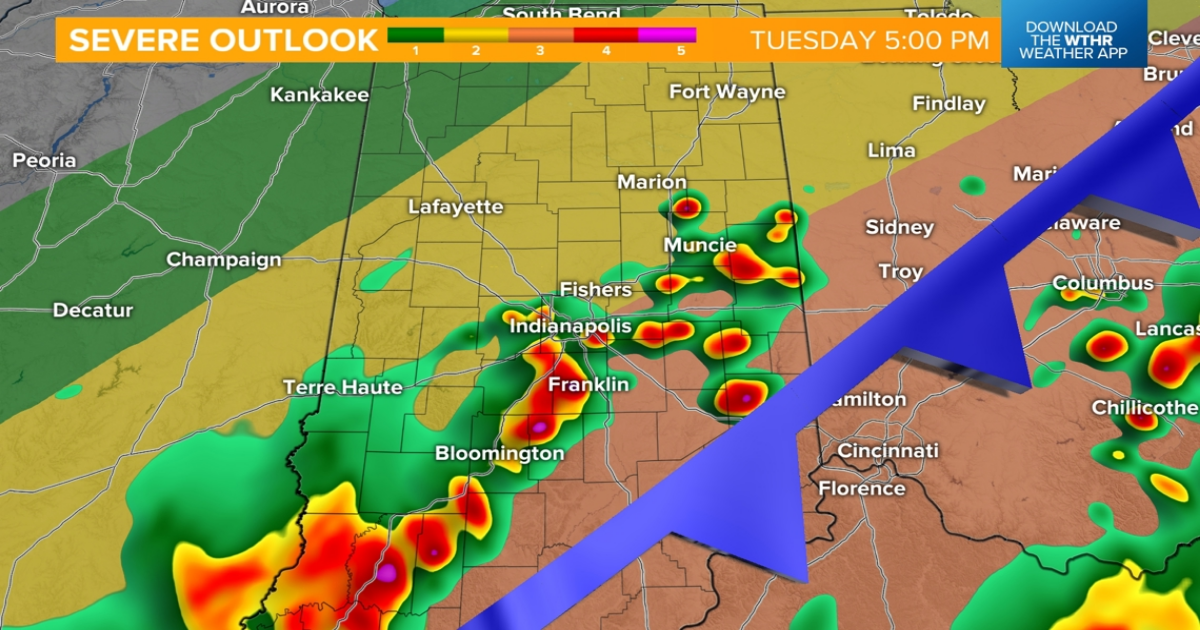
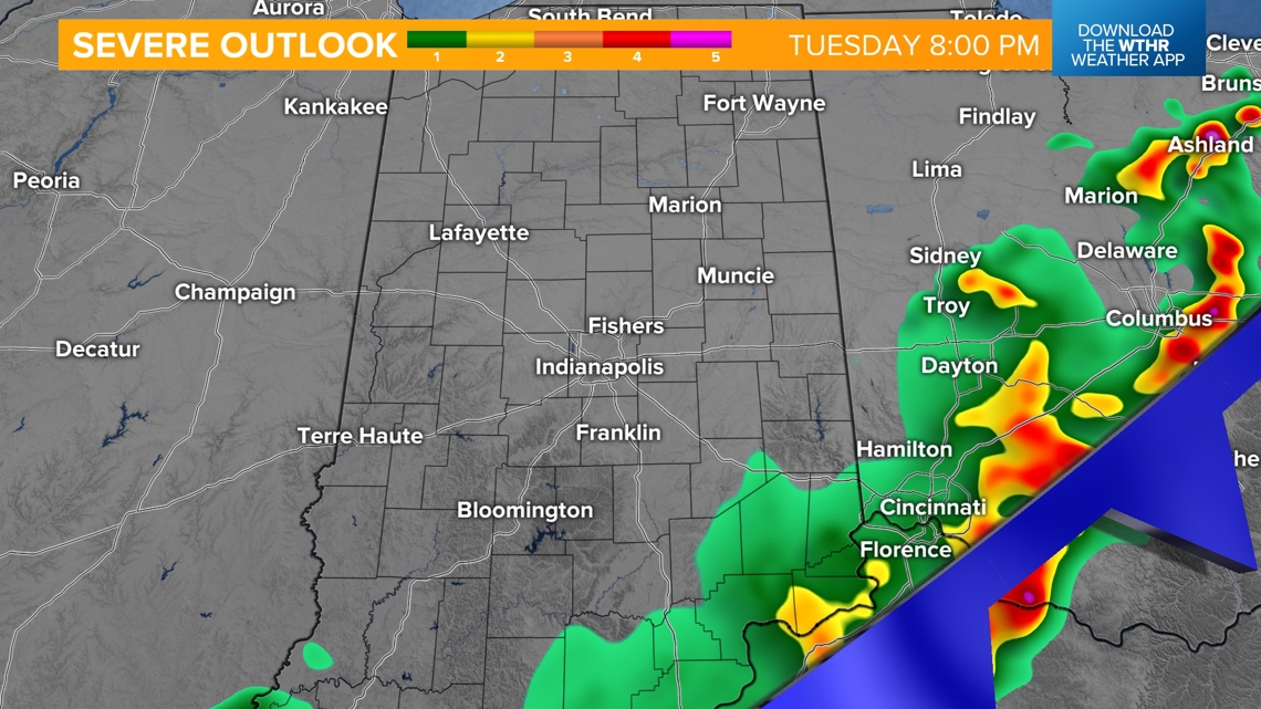
The Storm Prediction Center has upgraded the southeastern tier of the state from Indianapolis down to Bloomington over to the Cincinnati area to be under a level 3 of 5 for numerous severe storms possible. The rest of the state is under a level 2 of 5 for scattered strong to severe storms.

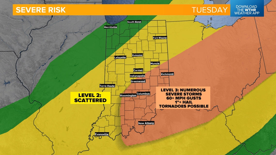
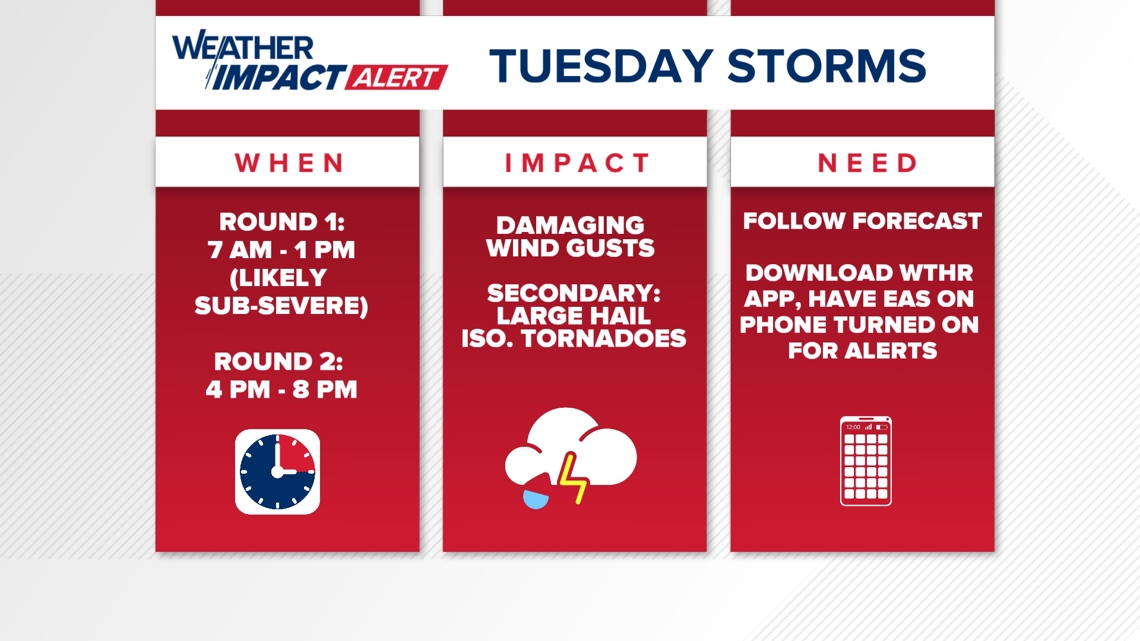
- WHEN: Round one with mainly non-severe storms this morning through 1 PM, Round 2 from 4 p.m. – 8 p.m. (mainly along and southeast of the I-69 corridor)
- IMPACT: Damaging wind gusts, secondary threats of large hail and isolated tornadoes
- NEED: Have multiple ways to receive warnings
- ***Note that the National Weather Service is going through a required update on their weather radio network and weather radios will be out now through Wednesday, April 30. Alerts will still be sent out but alternate ways to receive alerts will be required. We recommend making sure the EAS (emergency alert system) is turned on on your cellphone and you can download the WTHR weather app where alerts will be sent to your phone, as well.


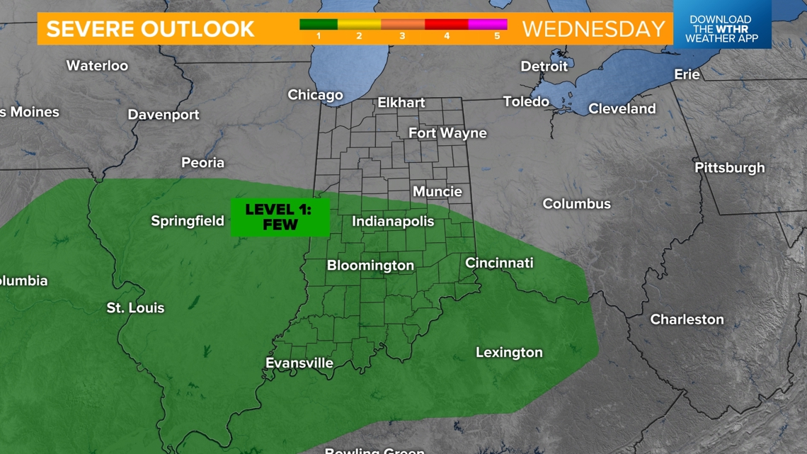
This boundary will then stall out across the Ohio River Valley overnight, keeping stray showers around across the southern tier of the state through Wednesday afternoon. Due to this, the Storm Prediction Center has kept a level 1 of 5 risk of an isolated severe storm in southern Indiana.

The rest of the state sees several dry hours Wednesday with temperatures topping out in the low 70s. The front will then lift back northward Wednesday evening and prompt scattered showers and perhaps some isolated storms through Thursday morning.
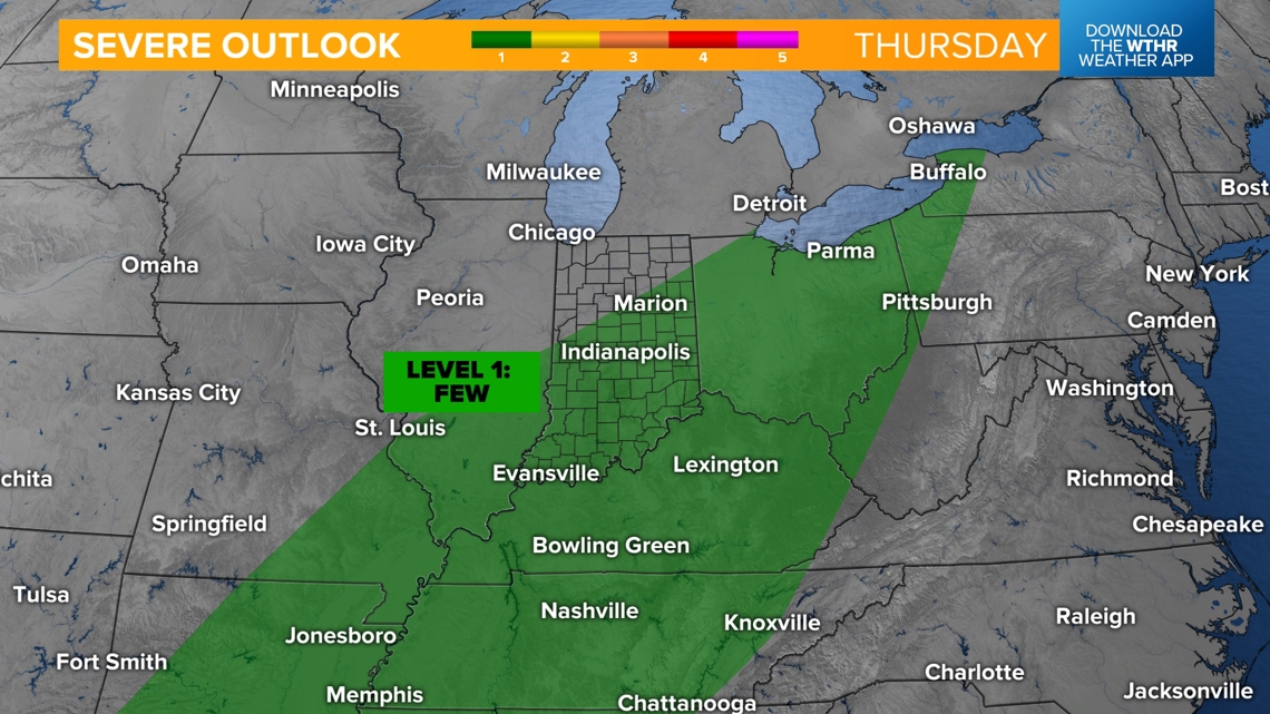
Thursday will be a wet and stormy day with this low pressure system tracking through the state. There will be ample ingredients for at least a low-end threat of severe weather in the late afternoon and evening with damaging wind gusts as the primary threat.

This system will eventually pull east on Friday with a few lingering showers possible. An additional 1″-2″ of rainfall will be possible. We’ll start next weekend with dry weather returning but briefly cooler temperatures with morning lows in the mid 40s and highs in the mid 60s for Mini Marathon Saturday. A more quiet setup will continue into next week with dry weather and more seasonal temperatures with highs near 70.