DALLAS — We’re tracking the latest forecast and weather updates on the WFAA+ streaming app. Don’t have WFAA+? Here’s how to download and install the app on your smart TV.
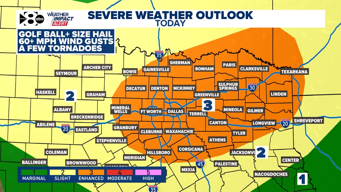
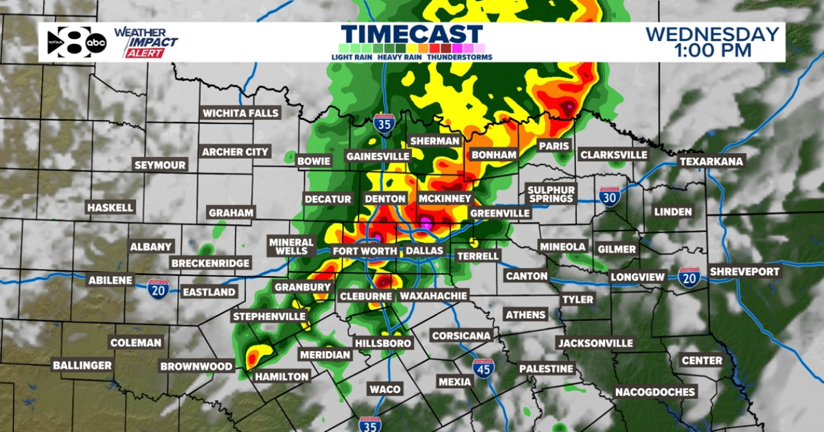
Storms are likely today (Wednesday). A strong storm system will intensify, bringing a dryline and a cold front to North Texas today. As this system interacts with the warm, moist air from the Gulf, thunderstorms will become more widespread. The storms could bring heavy rainfall, large hail, and strong winds, and a tornado threat.
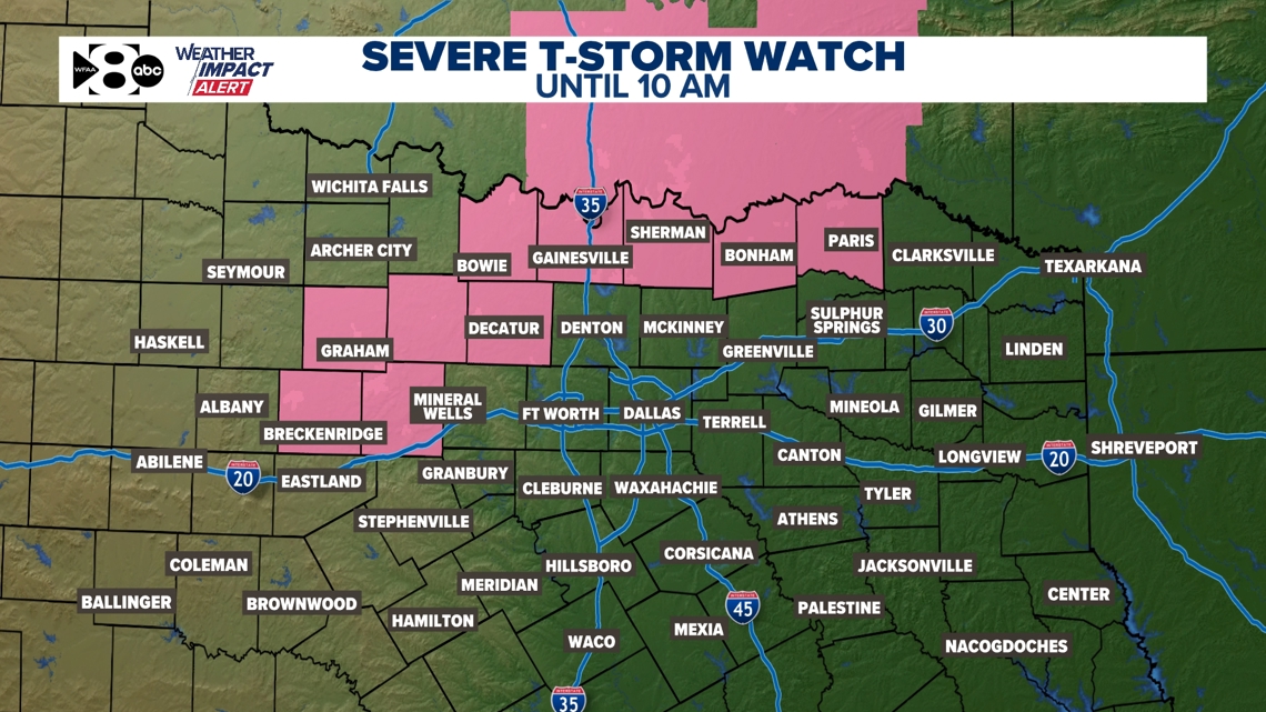
A Severe Thunderstorm Watch has been issued for parts of North Texas until 10 AM. Additional Watches are possible this afternoon that could include the DFW Metroplex.

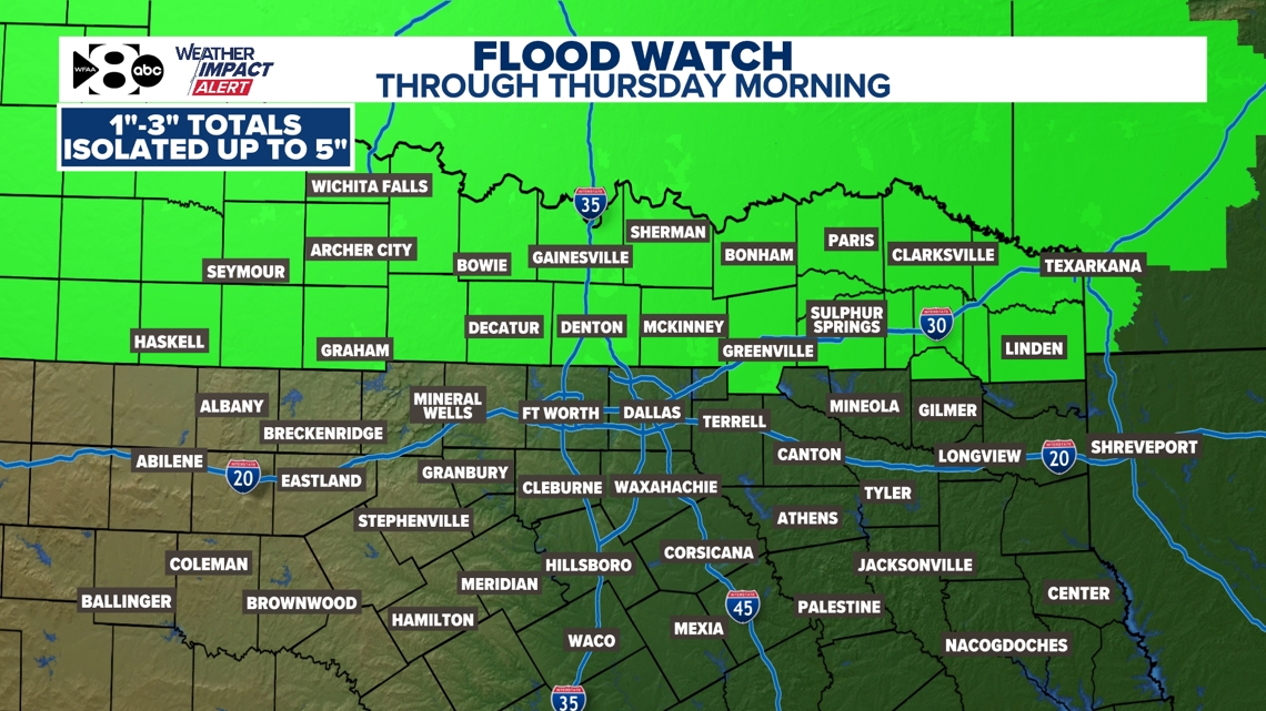
A Flood Watch has been issued for parts of North Texas through Thursday morning. Some of our northern counties could see a few inches of rain by the time storms move out later tonight.

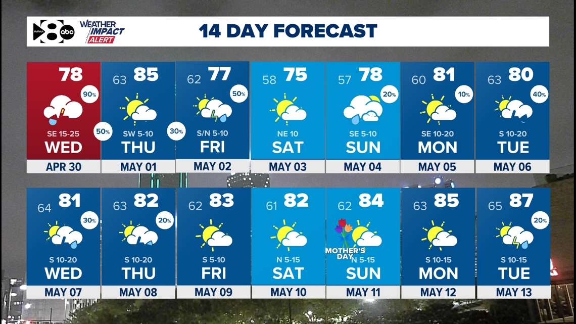
The rain and storm chances are expected to decrease by Thursday.
Severe storms are likely today (Wednesday). Storms over NW Texas this morning will march east into the afternoon. Storms will likely make it into the west metroplex by midday. Storms will strengthen as they move east across North Texas. All severe weather modes will be possible today that will include damaging wind gusts, golf ball size hail, and even tornadoes. Stay weather aware!