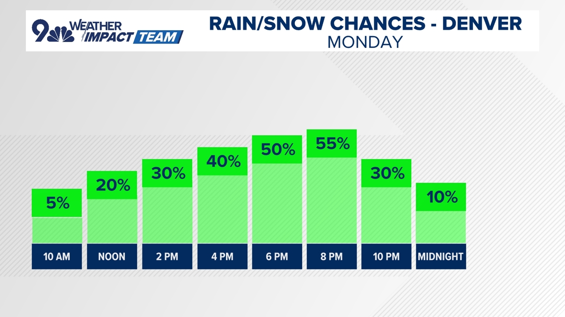
DENVER — Colorado will begin to see the impacts of a big spring storm on Monday, with southeasterly winds kicking up cloud cover and bringing in widespread showers and storms Monday afternoon.
The severe weather threat is low for Monday with a few rumbles of thunder and perhaps some small hail the main impacts from any storms. Most of the Denver area has about a 50 percent chance of showers and storms Monday, however, that risk increases in Douglas County and areas along and south of the Palmer Divide.
Highs in Denver will top out in the mid-60s on Monday before a much cooler and wetter look to both Tuesday and Wednesday.
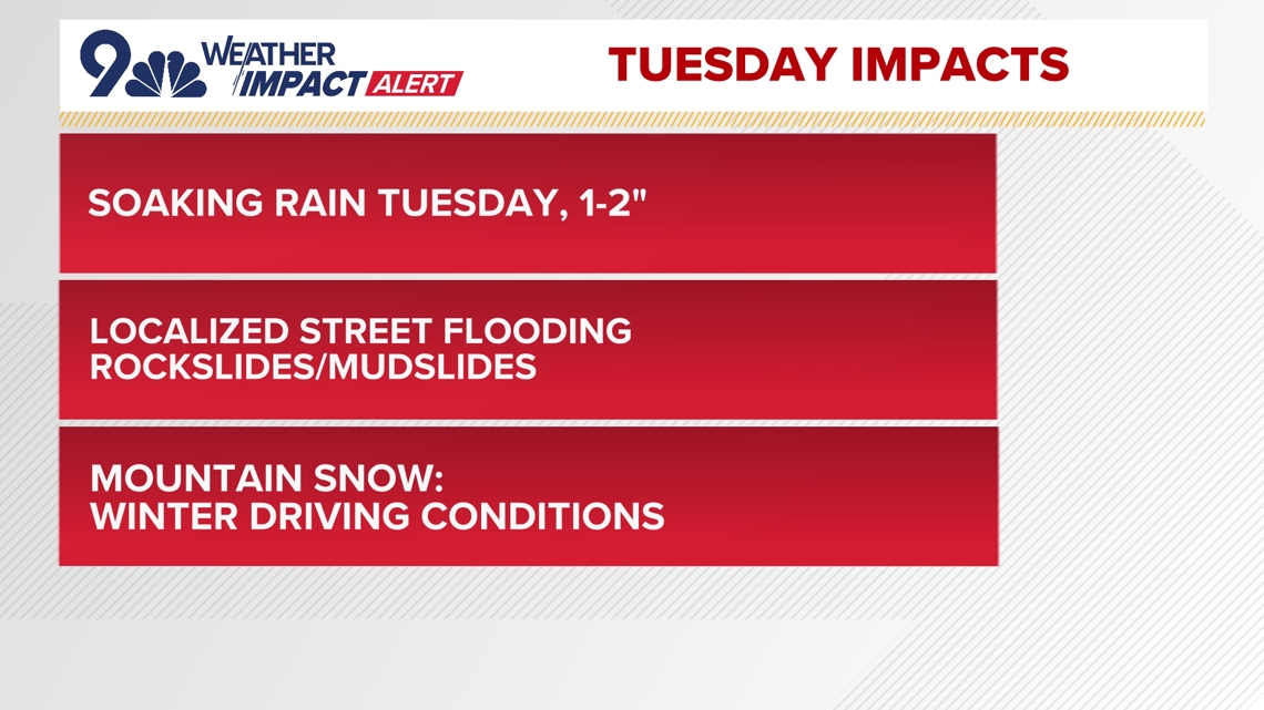
The 9NEWS Weather Impact Team has issued a Weather Impact Alert for Tuesday.
The bulk of the rain from this system will likely come on Tuesday afternoon and remain continuous into the late-night hours.
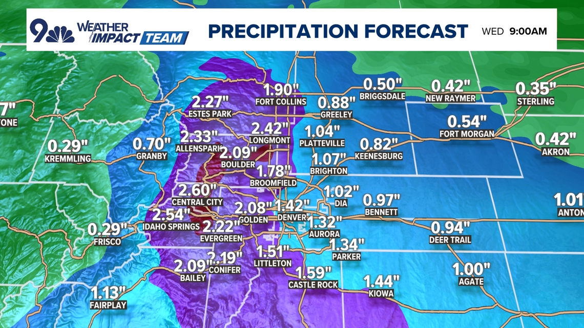
Watch for localized street flooding in the metro areas with mud and rockslides in the lower foothills where the precipitation will remain mostly rain instead of snow.
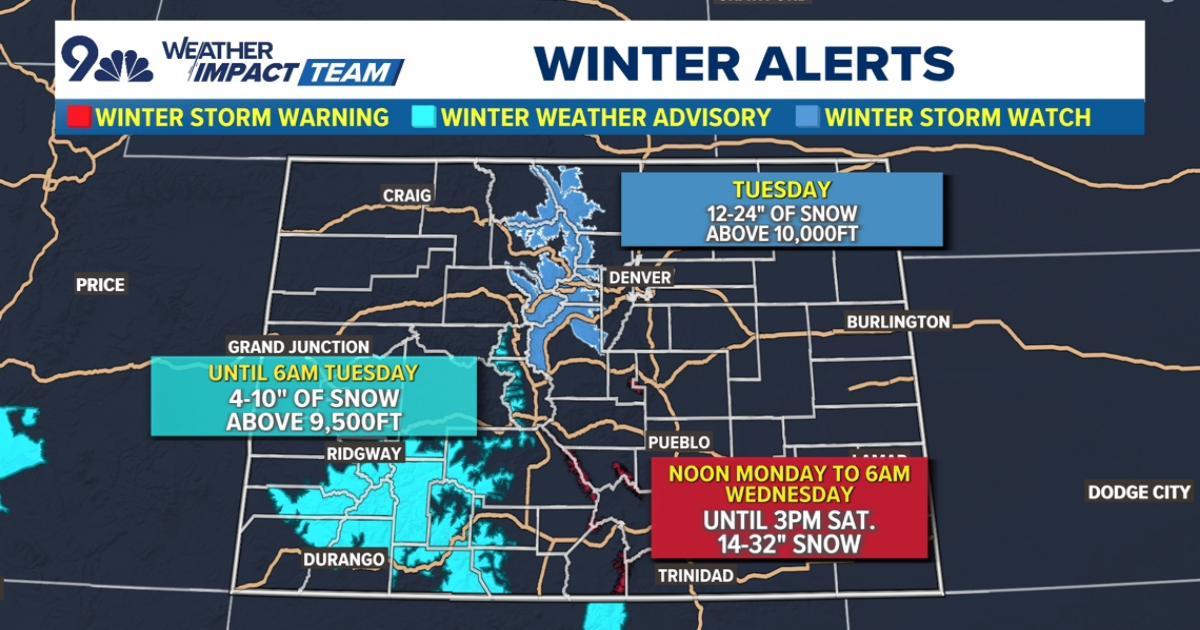
Most of the snow impacts will be above 8,000 feet with winter driving conditions likely at times on the mountain passes, especially on Tuesday. Towns in the higher foothills like Nederland, Ward, and Allenspark could get 6-12 inches of snow.
Some slushy snow will likely drop as low as the Palmer Divide and the lower foothills above 6,000 feet on Tuesday night and Wednesday morning, but impacts will be fairly limited below 7,500 feet (most of the foothills).
Areas at or above pass level could see as much as two feet of snow by the time the snow ends on Wednesday morning. Mountain travel will be very difficult on Tuesday and especially Tuesday night and Wednesday morning.


Warmer and drier weather will make a return to Colorado starting on Thursday, but as we warm back up, there will be enough low-level moisture hanging around to produce isolated afternoon showers and storms in the mountains as we approach the upcoming weekend. Still, Colorado will see overall warmer and drier weather after Wednesday.


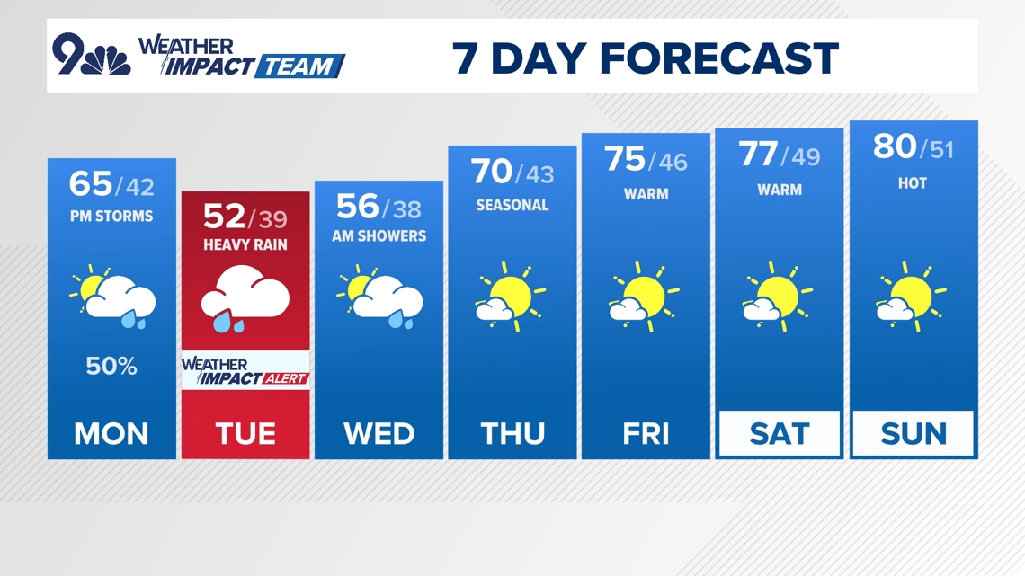
- MONDAY: Partly cloudy with a 50% chance for showers and thunderstorms in the afternoon and evening. High 65, low 42.
- TUESDAY: Cloudy with rain, heavy at times. High 52, low 39.
- WEDNESDAY: Mostly cloudy and cool with showers likely in the morning. High 56, low 38.
- THURSDAY: Mostly sunny, breezy, and warmer. High 70, low 43.
- FRIDAY: Warm and mostly sunny with a few afternoon storms possible. High 75, low 46.
- SATURDAY: Warm and mostly sunny. High 77, low 49.
- SUNDAY: Mostly sunny and warm. High 80, low 51.