- An impressive spring storm will bring widespread heavy rain and snow.
- Rain accumulations could approach 3″ with flooding possible.
- Snow accumulations over the mountains could reach double digits.
MONDAY: Showers and storms become widespread this morning. Already there is a threat of heavy rain and localized ponding or flooding. Snow is expected above 9,000 ft, sometimes a bit lower. Winds are breezy and highs are in the 50s.
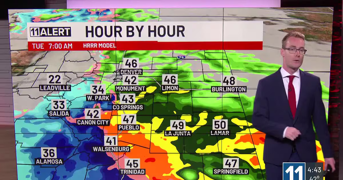
TUESDAY: After an overnight break from the rain, even heavier precipitation moves back in early Tuesday morning, likely impacting the morning commute. Heavy rain continues throughout the day with flooding likely, heavy snow is expected above 7,500 ft, including much of Teller County. Travel west of I-25 can become difficult or dangerous very quickly Tuesday! Winter Storm Watches and Warnings are posted. Snowlines can drop into Colorado Springs at times, but most of the snow this low down will melt immediately. Winds remain breezy and highs only reach 30s and 40s.
WEDNESDAY: We finally dry out, but rain and snow showers remain possible in the morning especially. Any additional moisture on saturated soils will pose a flooding risk. Temperatures climb into the 50s and 60s.
Copyright 2025 KKTV. All rights reserved.