CEDAR RAPIDS, Iowa (KCRG) – The weather remains mostly quiet through the end of the weekend.
A stray shower overnight
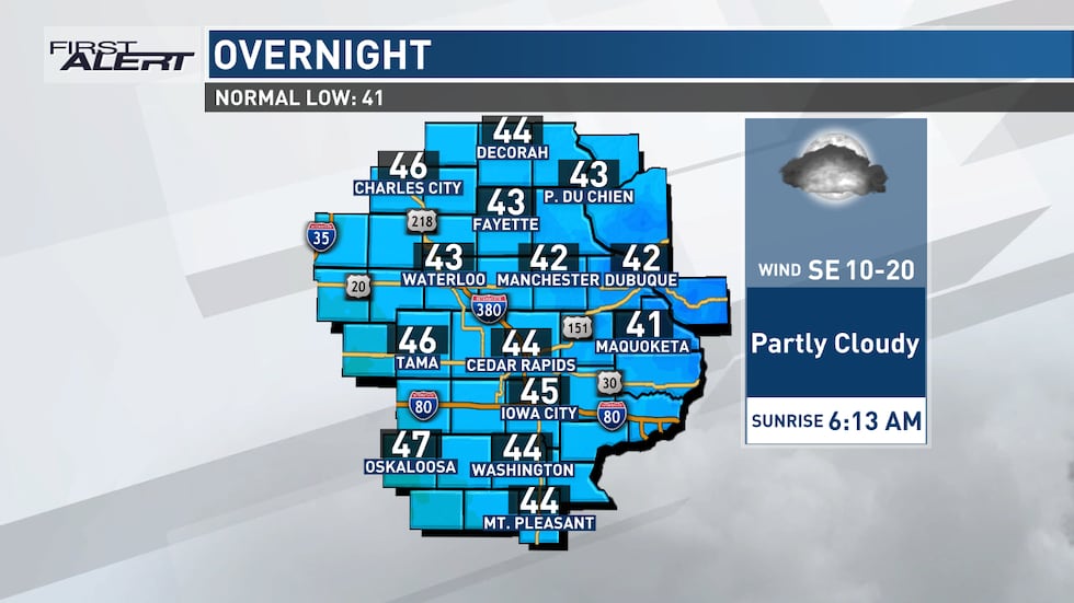
A stray shower or two is possible north of Highway 20 overnight, but any rain that falls will be scattered, light, and bring little if any impact. Lows fall into the low to mid 40s.
Seasonably cool overnight(KCRG First Alert Storm Team)
Clouds build on Sunday, a few showers possible
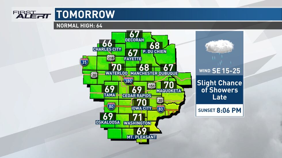
Sunday will feature more clouds than sun as southeasterly winds draw warm, moist air into eastern Iowa. Highs reach the upper 60s and low 70s, and there is the potential for a few scattered showers Sunday afternoon through Sunday night. The cloud cover and southeasterly winds keep us mild Sunday night as lows fall into the mid 50s.
Stray shower possible Sunday(KCRG First Alert Storm Team)
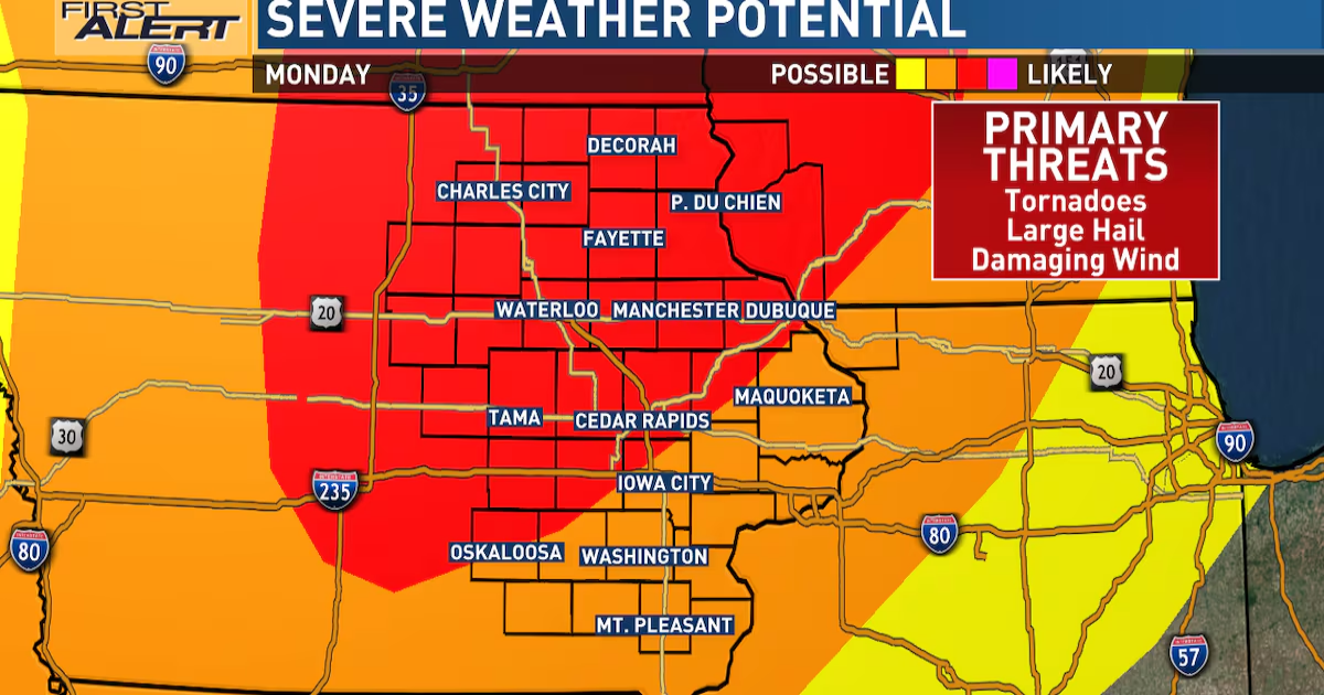
Your First Alert: Severe Threat on Monday
There is a moderate risk for severe weather across a majority of the TV9 viewing area on Monday. A potent low-pressure system will be passing to our northwest, bringing us warm, moist air and a favorable environment for strong to severe storms to form. Damaging winds, large hail, and tornadoes are all possible with any storms that form Monday. The current timing brings the heaviest severe storm activity into eastern Iowa Monday evening into Monday night, although a few severe storms could develop Monday afternoon, as well. Continue to check back for updates to the forecast over the next couple of days as we continue to provide you with updates on this incoming severe threat. A cold front moves through eastern Iowa late Monday night into early Tuesday morning and pushes the severe threat off to the east and out of our area.

The latest severe weather outlook for the day after tomorrow from the Storm Prediction Center. (KCRG)
What you can do to prepare now
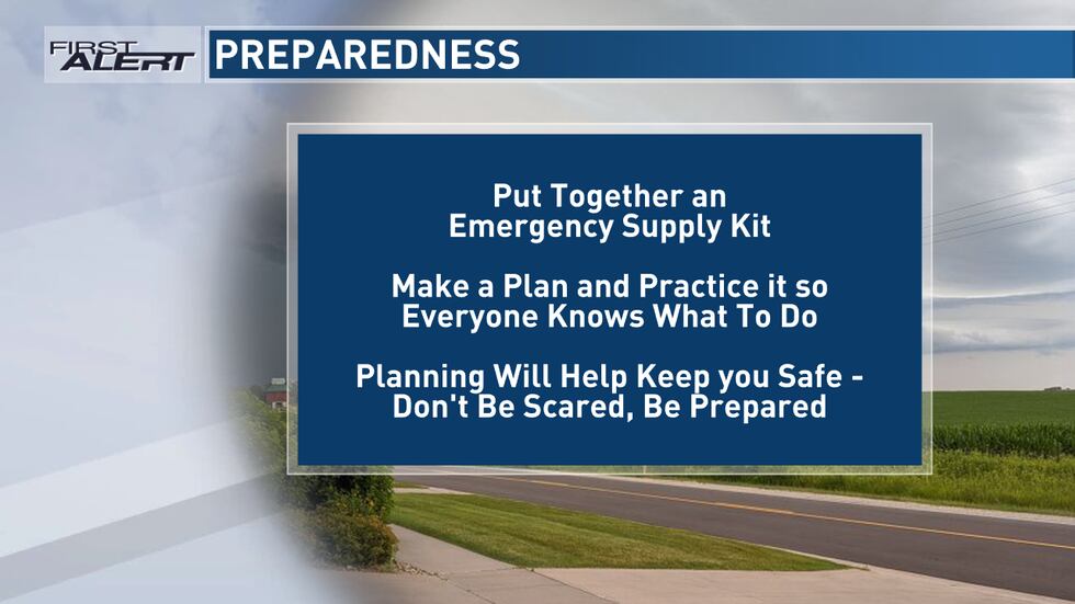
With the potential for severe weather on the horizon, you can prepare now by having multiple ways to receive warnings. A NOAA Weather Radio is a great tool in this case. Make sure it’s plugged in and turned on, ready to receive warnings, before you head to bed. We also recommend the KCRG-TV9 First Alert Weather App, which can give you customized alerts for your location. Of course, we’ll also provide updates on KCRG.com and KCRG-TV9 as conditions warrant.
Now is also a great time to practice what to do when a warning is issued for your area. Know where the safest places in your home are located as well as the fastest way to get there. You’ll want to make sure you’re getting to the lowest level of your home and putting as many walls between you and the outside as possible. A basement or interior bathroom or closet on the lowest level of your home are great examples. Make sure everyone in your family knows what to do and where to go, so that everyone in your family can be prepared when severe weather threatens.
Severe weather planning(KCRG First Alert Storm Team)
Your First Alert: More shower chances next week
After a dry day Tuesday, another chance for showers builds into eastern Iowa Wednesday and Thursday. Highs for the middle and end of next week range from the mid 60s to low 70s with lows in the upper 40s and low 50s.
We see a mostly quiet end to the weekend before strong to severe storms arrive on Monday.
Copyright 2025 KCRG. All rights reserved.