AUSTIN, Texas – Another round of storms is likely later today. The coverage and intensity of storms will be more than the last two days.
The National Weather Service issued several warnings and watches throughout the day on Friday, May 2.
All weather warnings and watches were cleared by 8 p.m.
Why you should care:

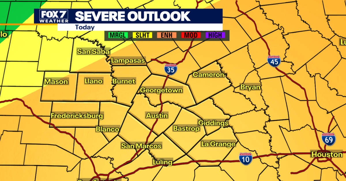
Much of the area is under a Level 3 (on a scale out of 5) enhanced risk for severe storms.
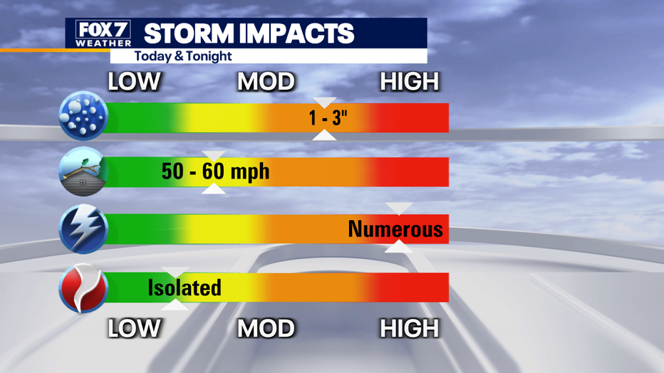
Quarter-to baseball-sized hail is possible along with wind gusts ranging from 50 to 60 mph.
Lots of lightning is expected and there could be some isolated tornadoes.
1 to 3″ of rain is expected in some spots with slight risk for some localized flooding.
A Severe Thunderstorm Watch has been issued for the following counties until 8 p.m.:
- Bell
- Milam
- Lampasas
- Gillespie
- Hays
- Caldwell
- Bastrop
- Blanco
- Lee
- Travis
- Llano
- Burnet
- Williamson
- Fayette
Timeline:
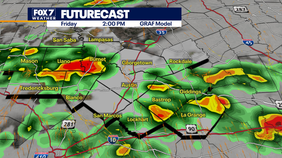
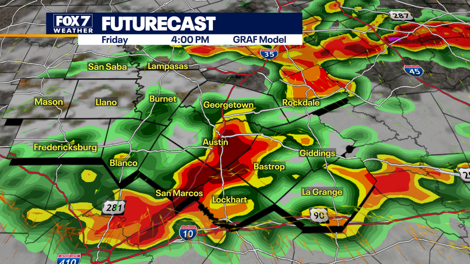
Exact timing is subject to change but the weather is supposed to hit between 1 p.m. and 8 p.m.
Ponding on roads is likely for the afternoon commute and then some low-water crossings could flood.
What you can do:
Track your local forecast for the Austin area quickly with the free FOX 7 WAPP.
The design gives you radar, hourly, and 7-day weather information just by scrolling.
Our weather alerts will warn you early and help you stay safe during storms.
The backstory:
This is the second day for severe storms in our area.
On Thursday, May 1, the National Weather Service issued several warnings and watches, including a tornado warning for Williamson, Lampasas, and Burnet Counties.
The NWS also confirmed a tornado was on the ground in northeast Burnet County around 4:20 p.m.
Burnet County said one house and large outbuilding were destroyed. Another house was damaged.
The Source: Information from National Weather Service and meteorologist Zack Shields.