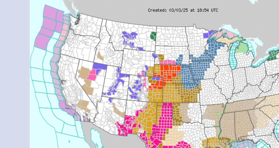
The National Weather Service issued blizzard warnings in the Great Plains on Monday, as a system that will bring snow and high winds is expected to ramp up early Tuesday morning.
“Whiteout conditions are expected and will make travel treacherous and potentially life-threatening. Plan on slippery road conditions. The hazardous conditions could impact the Tuesday morning and evening commutes. Very strong winds could cause extensive tree damage,” the NWS office in North Platte, Neb., said Monday in an “urgent” winter weather alert.
Wind gusts
Blizzard conditions are expected in Arkansas, Colorado, Kansas and Nebraska before the system moves east and takes aim at the upper Midwest. Wind gusts as high as 70 mph in the Central Plains are forecast for Tuesday, making travel difficult in many areas, the NWS said. The upper Midwest is expected to be hit with 50 mph wind gusts beginning Tuesday night.
“Travel should be restricted to emergencies only. If you must travel, have a winter survival kit with you. If you get stranded, stay with your vehicle,” meteorologists said in an alert.
Snow
Missouri, Iowa, Minnesota, Illinois and Wisconsin are all forecast to see some snowfall as the storm pushes through. While the heaviest totals are expected in the Rocky Mountains, states like Iowa and Wisconsin could see as much as 8 inches.
“There is some uncertainty about how long that blowing snow will linger after the falling snow has ended,” NWS meteorologist Brooke Hagenhoff told Radio Iowa. “So anyone who’s out and about on Wednesday will definitely want to take it easy and check road conditions before they head out.”
Widespread effects
The impacts of the massive storm system will also extend to other parts of the country. Power outages due to high winds are expected in Texas, Oklahoma, Florida and parts of the Northeast.
“Large hail and damaging wind gusts are the primary hazards. This activity will persist thru Tuesday morning until exiting the region by midday Tuesday,” the Tulsa NWS office said in a social media post on Sunday.
Wildfire risk
Despite the snow and rain that the system will bring to many states, states like New Mexico and Texas will see an increased risk of wildfires from the storm thanks to a combination of high winds, low humidity and warm temperatures. Along with high wind warnings, the NWS posted red flag warnings in New Mexico, Texas, Oklahoma and portions of Kansas. Red flag warnings indicate that conditions are favorable for wildfires.