A blizzard warning was issued Monday for northern El Paso County by the National Weather Service in Pueblo.
The warning is scheduled 7 p.m. Monday through 3 p.m. Tuesday.
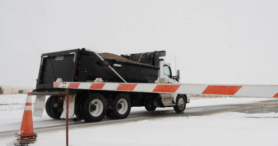
Dangerous travel conditions are expected for the Tuesday morning commute through the evening commute, especially from the Interstate 25 corridor east to the plains, the Weather Service said in a social media post.
Some schools and colleges, including Academy District 20 and District 49, have closed or delayed start times for Tuesday. Click here for the latest list of delays and closings.

Total snow accumulations between 4 and 10 inches are expected along with winds gusting as high as 70 mph in areas along the Palmer Divide including Black Forest and Monument.
Visibilities may drop below a quarter mile because of blowing snow. “Whiteout conditions will be possible which will make travel treacherous and potentially life-threatening,” according to the Weather Service.

Earlier Monday, Colorado Springs was forecast to reach a high of 59 degrees with many areas in the Pikes Peak region under a red-flag warning for high fire danger until 7 p.m.
“Most accumulations from the storm will be above 6,000 to 6,500 feet, with a sharp cut off between little to no snowfall and very high totals,” said Alan Rose, meteorologist with Gazette news partner KOAA.
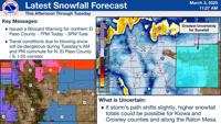
According to Rose, downtown Colorado Springs may only see a few inches of snow while the north side of the city could see as much as 4 to 8 inches, and even larger snow totals at higher elevation.
Heavy snow, with accumulations of up to 17 inches and gusts as high as 50 mph, will affect the mountain passes, according to the Weather Service.
“It will also be very windy and colder on Tuesday, with gusts around 50-60 mph in Colorado Springs during the first half of the day,” Rose said. “A relatively calm day will follow on Wednesday with our high in the middle to upper 40s.”
Preparing for the storm
Evening crews with the city of Colorado Springs were preparing their snow and ice equipment Monday and ready to deploy when snowfall begins, officials said in an email.
A full callout of crews was scheduled begin at midnight Tuesday.
Forecast
Here’s the four-day forecast from the National Weather Service:
Tuesday: A 50% chance of snow showers before 11 a.m. Areas of blowing dust before 2 p.m. Partly sunny, with a high near 41. Windy, with a north wind 25 to 35 mph, with gusts as high as 50 mph. New snow accumulation of less than a half inch possible.
Wednesday: Sunny, with a high near 47. Light and variable wind becoming south southeast 5 to 10 mph in the afternoon.
Thursday: A 30% chance of showers, mainly after 5 p.m. Mostly sunny, with a high near 54. Breezy, with a west wind 5 to 10 mph becoming southwest 15 to 20 mph in the afternoon. Winds could gust as high as 30 mph.
Friday: A 50% chance of snow showers. Mostly cloudy, with a high near 42. North wind around 10 mph.