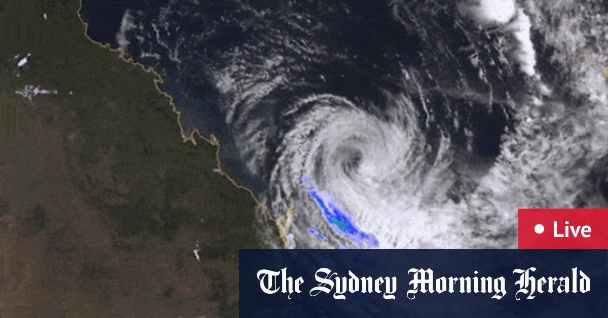
The Bureau of Meteorology has just released a new update on the tracking of Cyclone Alfred – and it could now hit a little earlier.
It said Alfred is slow-moving but is expected to make landfall along the southeast Queensland coast on Friday night or early Saturday morning, bringing flash flooding and destructive winds.
Loading
Residents on the Mid-North Coast, Northern Rivers and the Northern Tablelands, east of Tenterfield, should prepare for heavy rain, which could lead to flash flooding, the report released on Friday at 3am AEDT stated.
They should also brace for damaging winds with gusts of 100km/h possible across parts of the Northern Tablelands starting from Friday morning and continuing into Saturday.
On the Northern Rivers – as far south as Cape Byron – those gusts could reach 155km/h on Friday.
Areas of NSW in the direct path of the damaging winds and rain include Lismore, Grafton, Coffs Harbour, Tenterfield, Yamba, Woolgoolga, Sawtell and Dorrigo.