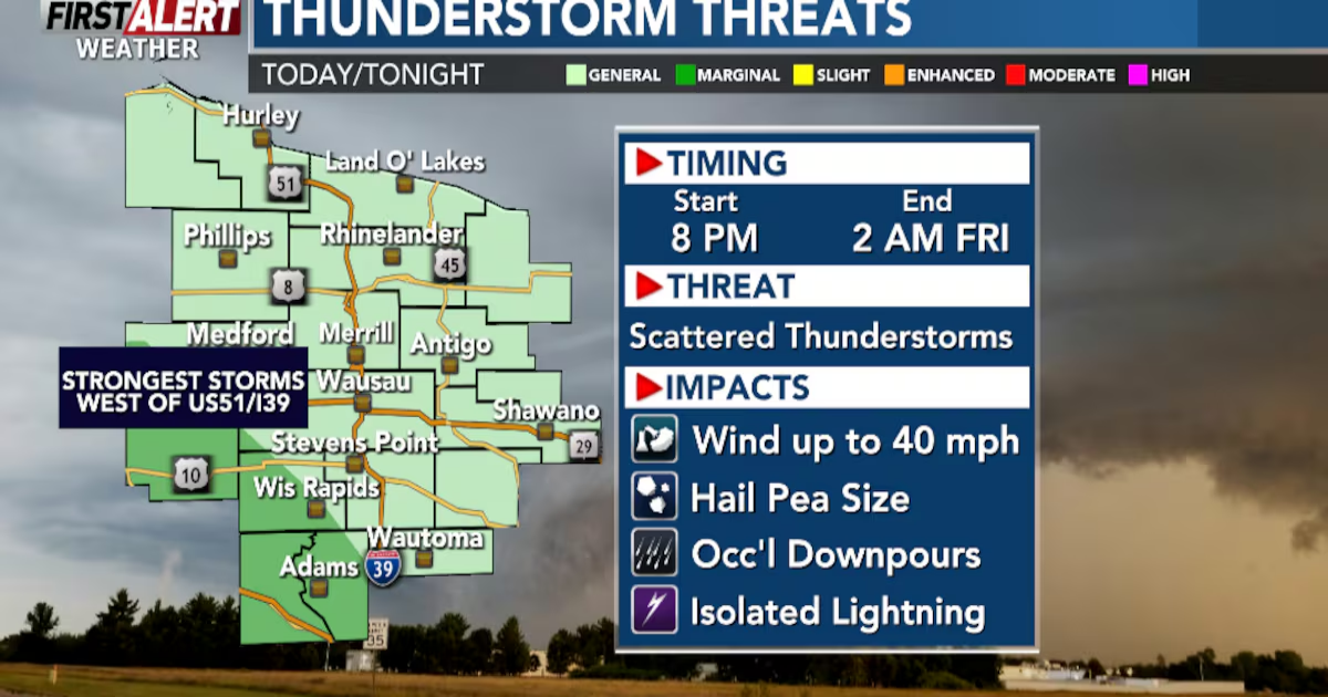
WAUSAU, Wis. (WSAW) – A chance of showers and thunderstorms this evening. Severe weather remains most likely to occur to our southwest in Minnesota and Iowa, but a couple of strong storms cannot be ruled out in our area. Any threat of strong storms would come due to hail. They would most likely occur this evening. Most of the rainfall should take place late tonight through early Friday morning, but scattered showers remain in the forecast on Friday afternoon.
Rainfall amounts along and south of Hwy 29 will range from .50″ to 1.00″ of rain. Lesser amounts of rain north of Hwy 29.
Thunderstorms are possible Thursday night into Friday morning(WSAW)

Showers and storms are possible(WSAW)
For Easter Weekend… it’s a tail of two days. Saturday will be dry with highs in the low to mid-50s with partly cloudy skies. Easter Sunday will start out dry, but feature considerably more clouds overall. In addition, more rain is still in the forecast Sunday afternoon through Monday. It’s still early to tell how much rainfall we could get, but some snow cannot be ruled out as well early Monday morning. Snow would likely struggle to accumulate with all the Spring-like Weather we will have leading up to snowfall taking place.
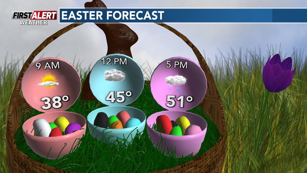
Easter Egg Hunt forecast.(WSAW)
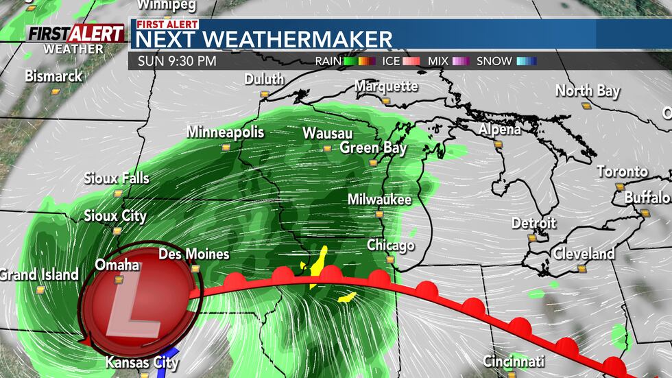
Rain will become widespread late Sunday, continuing through the overnight.(WSAW)
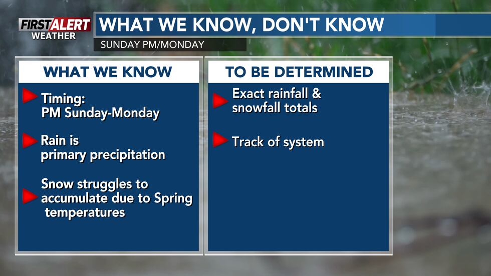
Information on Easter Sunday through Monday.(WSAW)
For the most part, highs will top out in the mid-50s, across the region, over the next seven days. This is right around average for this time of year.
Copyright 2025 WSAW. All rights reserved.