WASHINGTON – Tornado warnings and watches have been issued for the D.C. region as severe weather moves through the area.
Tornado warnings and watches in DC region
What we know:
A tornado warning has been issued for Calvert County and St. Marys County until 9:00 p.m. and for Anne Arundel, Howard, Montgomery and Prince Georges County until 9:15 p.m.
A tornado watch has been issued for the D.C./Baltimore area until midnight.
Tornado watches are in effect for the following areas until midnight:
- District of Columbia
- Arlington County
- Stafford County
- Prince William County
- City of Manassas
- Fauquier County
- City of Fairfax
- City of Alexandria
- City of Fredericksburg
- Fairfax County
- Charles County
- Prince Georges County
- Carroll County
- Frederick County
- Anne Arundel County
- Montgomery County
- Culpeper County
- King George County
- Loudoun County
- Spotsylvania County
- Baltimore County
- Calvert County
- Howard County
- St. Marys County
- Washington County
- Baltimore City
Severe Thunderstorm Warnings issued in DC, Maryland & Virginia
A severe thunderstorm warning is in effect until 8:30 p.m. in the following areas.
- Frederick County
- Anne Arundel County
- Prince Georges County
Flash flood warnings for DC region
Flash flood warnings are in effect until 11:00 p.m. in the following areas.
- Howard County
- Montgomery County
- Prince Georges County
Flash flood warnings are in effect until 11:15 p.m. in the following areas.
- Anne Arundel County
- Baltimore County
- Howard County
- Baltimore City
Friday night severe weather forecast
Showers and thunderstorms are expected to push through the D.C. area Friday night. The National Weather Service has issued a Flood Watch beginning at 7 p.m. for the District and areas along the I-95 corridor in central Maryland and northern Virginia. Some locations could see up to four inches of rainfall.
Instability in the region is up thanks to higher than expected temperatures throughout the day. A deepening wave of surface low pressure will be passing just to the west of our region. Tornado potential has raised from 2% to 5%, which is higher than normal for the D.C. area.
The most severe weather should be expected around 3pm to 6pm to the west of D.C., and then from 6 p.m. to 9 p.m. closer to D.C. and to the east.
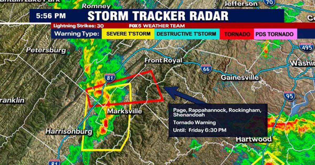
The highest risk for tornado warnings Friday night will be from the I-66 corridor and south, Southern MD, Northern VA, and the northern Neck.
Related
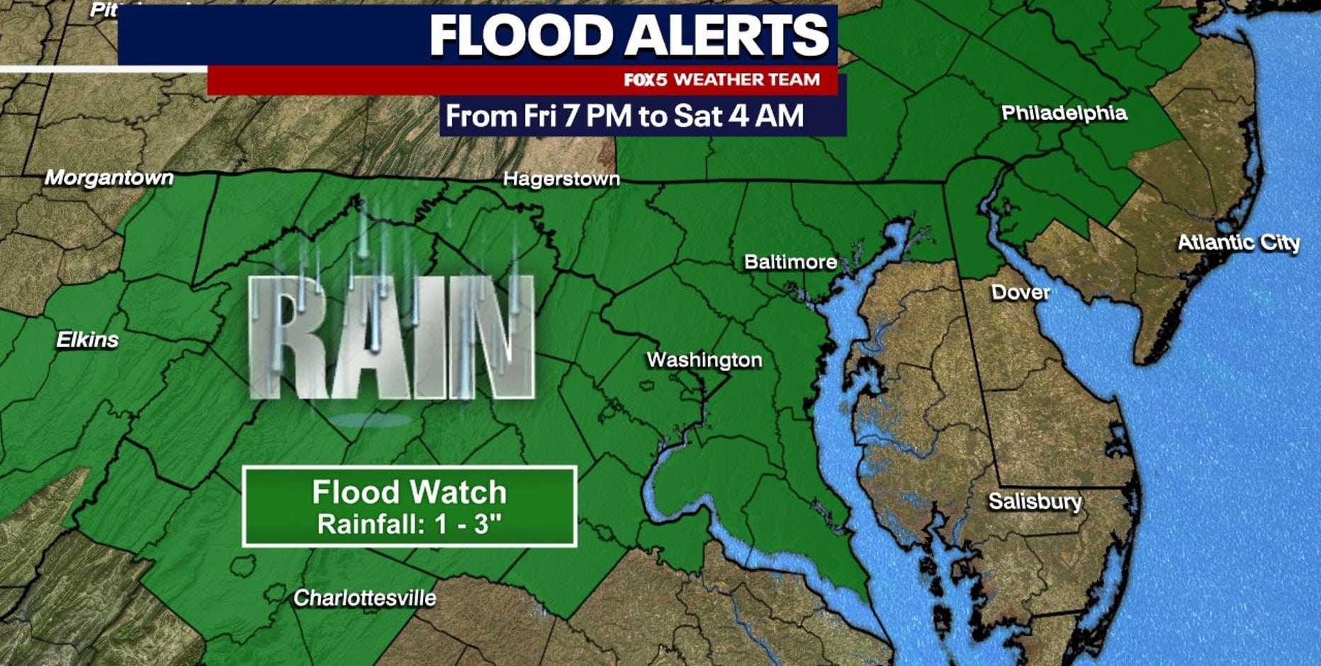
A Flood Watch is in effect across the Washington, D.C. area on Friday as showers and thunderstorms push through later tonight, bringing the risk of heavy rainfall and potential flooding.
In addition, heavy rains in thunderstorms could lead to flash flooding, in addition to a standard damaging wind threat.
Severe WeatherWeatherNewsTop Stories