by Meteorologist Jeannette Calle
Tue, March 25th 2025 at 1:41 PM
Updated Wed, March 26th 2025 at 7:40 AM
Much needed rainfall for our viewing region is ahead including Bexar County and San Antonio.
SAN ANTONIO – Much needed rainfall for our viewing region is ahead including Bexar County and San Antonio.
CLICK HERE to track the rain with our interactive radar…
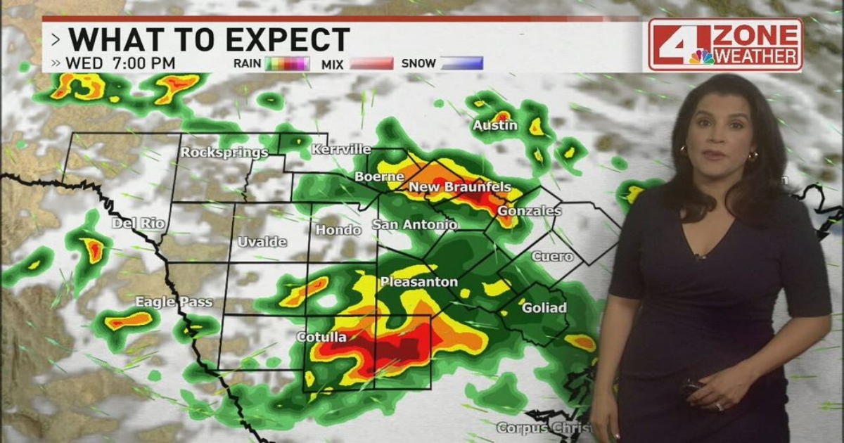
The first chance of rain is today. This is an earlier arrival time from previous forecasts based on latest trends. This morning is just cloudy but by early afternoon, we’ll see developing showers and thunderstorms in our southwestern parts of the viewing area. Gradually through the afternoon, some of this rain will push north in and around Bexar County.
There is a marginal severe storm outlook to the west and south from San Antonio where we can’t rule out a storm with wind gusts and hail. We’re also in the “excessive rainfall outlook” from the Weather Prediction Center. This outlook covers the risk of flash flooding.
After this first wave of rain, we’ll watch for redevelopment later tonight through Thursday. Additional patches of rain or thunderstorms possible Thursday night to Friday morning before it moves east and out of our region. Total rainfall will range from .75″ – 2″+ in our western tier to 1″ – 3″+ rainfall in and around Bexar County and the I-35 corridor. Our eastern half and to the south will see a 3″ – 7″+ total rainfall.
Temperatures will be much cooler too in the 70s Wednesday then the 60s on Thursday.
CLICK HERE to share your photos and video…