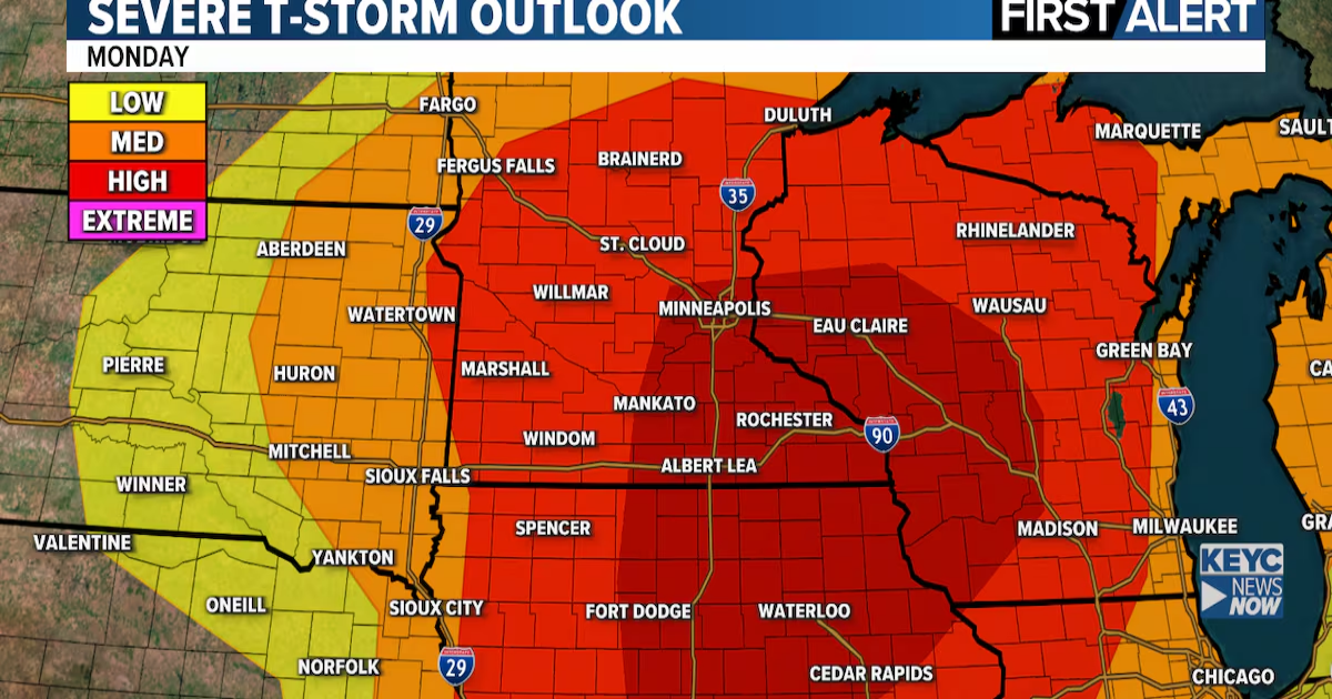
A severe weather outbreak remains likely Monday afternoon and evening across parts of the Upper Midwest, including southern Minnesota and northern Iowa. Very large hail, damaging winds and strong tornadoes are expected, especially by late afternoon and early evening.
Storms may first develop early Monday across southern Minnesota and northern Iowa. More discrete, isolated supercells farther south could produce strong tornadoes. By late evening, a line of severe storms is expected to sweep east with widespread wind damage and embedded tornado threats.
Key points:
- Greatest tornado threat: southern MN into IA and WI.
- Locations near and east of a line from Worthington MN to Sioux City IA could see the first activity early Monday afternoon.
- Areas north of US Hwy 14 in MN will likely see more cloud cover and morning storms, lowering but not eliminating the risk there.
Please prepare now. Have multiple ways to receive warnings and review your severe weather safety plans ahead of Monday.
Severe storms and tornadoes are possible Monday afternoon and evening(KEYC Weather)
Watches, Warnings and Advisories
 This image updates in real time as information changes.
KEYC First Alert 10 Day Forecast

Planner Forecast
 KEYC First Alert Planner Forecast: This image updates in real time as the forecast changes.
Click here to download the KEYC News Now app or our KEYC First Alert weather app.
Copyright 2025 KEYC. All rights reserved.