by Chief Meteorologist Chris Suchan
Fri, April 4th 2025 at 4:14 PM
Updated Sat, April 5th 2025 at 3:48 AM
We have a marginal to slight severe storm outlook across our region from the Storm Prediction Center.
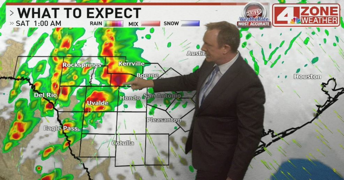
SAN ANTONIO – Strong to severe storms will move into the area this morning. A few storms may produce hail up to an inch or strong wind over the coastal plains through around noon. We have a marginal to slight severe storm outlook across our region from the Storm Prediction Center.
CLICK HERE to track the storms with our interactive radar…
A round of storms with the potential of becoming severe will develop out west then spread east to northeast. The bulk of these heavy storms will be from the Hwy 90 corridor from Medina to Kinney County and north across the Hill Country. However, these storms may scrape western to northern Bexar County as they pass by. They’ll be capable of large hail and strong gusts through the night.
The severe risk will lower after 4am and we’ll see scattered showers or leftover thunder through 8am then we settle into a partly sunny, cooler and windy Saturday. The rain chance later Saturday will be out west where a shower or storm will be possible.
CLICK HERE for the complete forecast…
