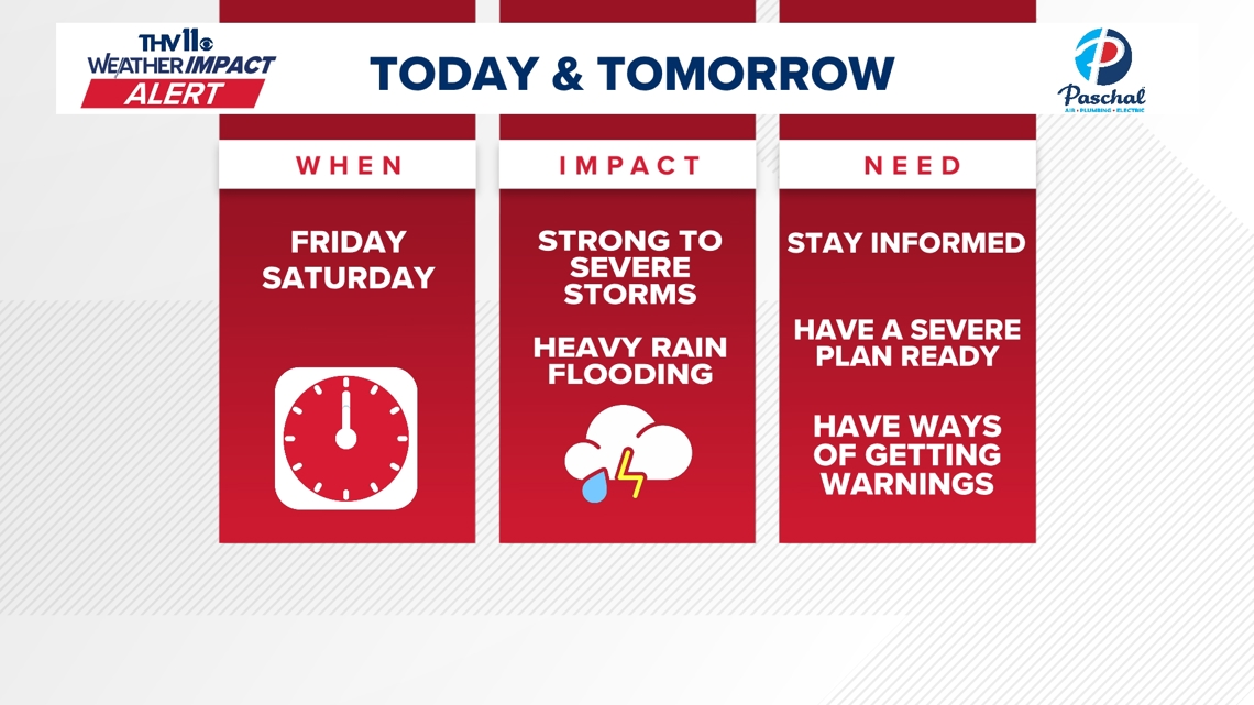
LITTLE ROCK, Ark. — After two rounds of severe weather events have passed in Arkansas, a TH11 Weather Impact Alert remains in effect through Saturday.
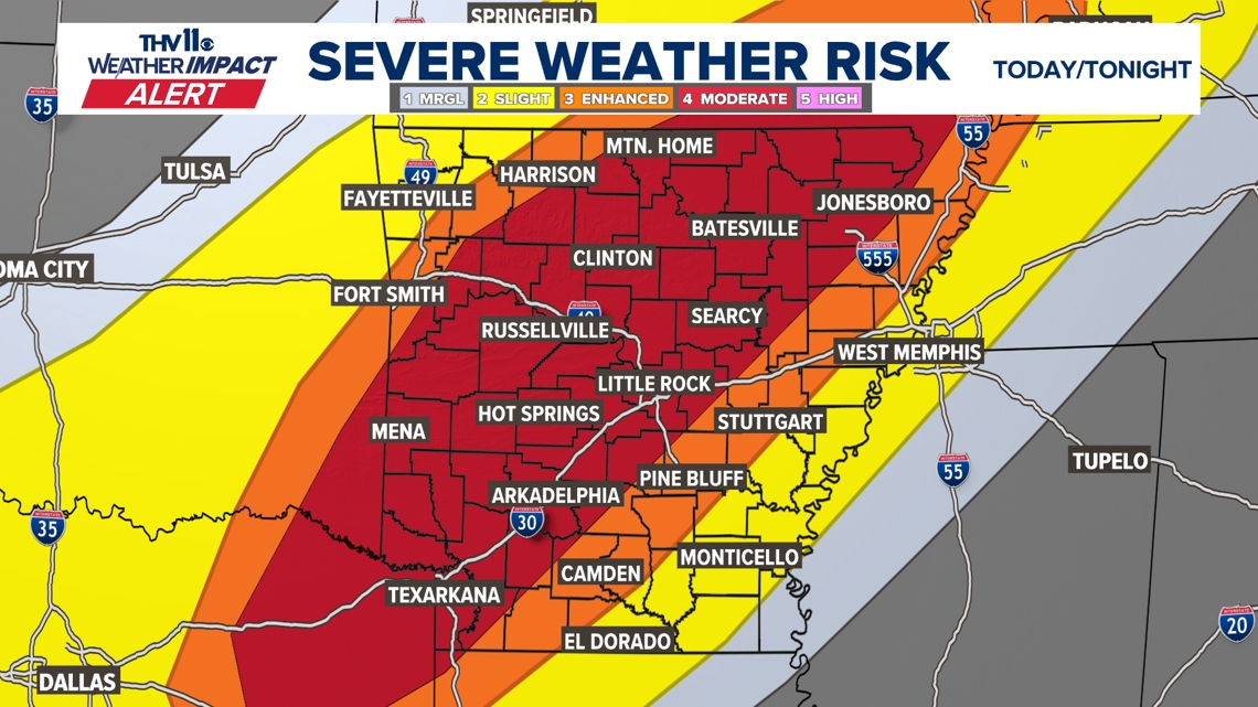
Another round of severe thunderstorms is possible throughout the day on Friday. The primary threat with this system is flooding, but a couple of tornadoes and large hail cannot be ruled out.
On Friday, the National Weather Service of Little Rock issued a tornado watch for a large part of Arkansas until 9 p.m. central time. The watch also included parts of Louisiana, Oklahoma, and Texas.
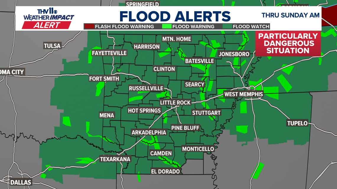
The threat of flash flooding in Arkansas continues through Saturday as wave after wave of thunderstorms will produce heavy downpours over areas that have already received a couple of inches of rain.
The Jefferson County Office of Emergency Management issued a warning that the National Weather Service is predicting the Arkansas River level at Pine Bluff will rise to approximately 44 feet by Tuesday, April 8.
This may cause minor flooding along the river, and roads inside the levees will be closed.
Tornadoes, large hail, and damaging winds are all possible. So it’s very important to stay weather aware.


On Friday, another surface low-pressure area and a cold front will begin to enter Arkansas.
This storm system will interact with a very unstable environment. Storms will be capable of producing damaging winds, large hail, and tornadoes on Friday afternoon and into Friday night.
Depending on the speed of the system, storms may last into the overnight hours.


In addition to the potential for severe weather, there will be an issue of flooding from Friday to Sunday morning, and some areas will see anywhere from 7 to 10″ of rain.
Expect areas of heavy rain each day to set up across parts of Arkansas. This can easily add up to several inches of rain in one day.
Flooding will be possible to likely for small creeks, rivers, low-lying areas, and poor drainage areas. Significant river flooding along the White River, Ouachita River, Saline, Little Missouri, Petit Jean, and Buffalo River will be possible.
Never drive through floodwaters, especially if it is moving. You don’t know how deep it is, and the road may be washed out.
Make sure to have several ways of receiving warning notifications. Also, it’s a great time to go over your severe weather safety plan with your family, just in case a warning is issued.
Some good advice to stay safe is to put the mattress by the bathroom, pillows, and have all of that ready to go.
Gather the pets when a watch is issued. Take pictures of your home. Place important documents in a sealed bag or container and find a safe place for them. Gather your medicines and place them in your shelter or a safe place.
If warnings are issued, be sure you follow us on the THV11 + streaming app. It’s a FREE download for your television from AppleTV+, Amazon Firestick, Roku devices, and Samsung smart TVs.
As always, we appreciate your weather reports, pictures, and videos, but your safety is our primary concern. Don’t risk your safety by getting a photo or video.
You can text your reports or pictures to (501) 376-1111 or submit them to our THV11 Weather Watchers Facebook page.
