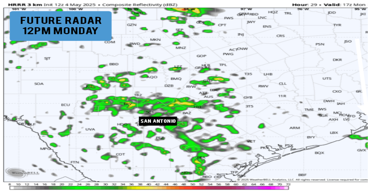
Shown is the future radar at noon Monday, as scattered showers and weak storms move across Central and South Texas.
WeatherBell
It was an absolutely gorgeous weekend across South Texas. San Antonio saw picture perfect weather for Fiesta Flambeau Saturday night, and we followed it up Sunday with below normal temperatures and mostly sunny skies across the region.
The weather pattern is about to change, though. A broad area of low pressure has moved over the Desert Southwest, and as it continues to trek eastward, it’ll will bring increasing rain chances to the Lone Star State. Some storms could be strong to severe through the middle of the week, even here in the San Antonio area. Here’s a day-by-day timeline of what you can expect.
Monday: The early morning will likely be relatively dry. However, overcast skies are expected, as well as a low chance of an isolated shower between 5 and 9 a.m. Temperatures will be cool, likely hovering in the mid- to upper 60s throughout the morning hours.
Article continues below this ad
Rain chances will increase significantly during the late morning and afternoon, especially between 10 a.m. and 4 p.m. We are not expecting rain the entire time, rather you can expect off-and-on showers and storms. Severe weather is also not expected during this time, but a few rumbles of thunder can’t be ruled out either. Overall rain chances are about 60%.
Temperatures are expected to stay below average for early May, rising only into the mid-70s during the afternoon. A few showers are possible through the evening as well, but overall rain chances will decrease as the day goes on.
Elsewhere across Texas, a significant severe weather threat is expected out in West Texas Monday afternoon and evening, where very large hail and a few tornadoes are possible. A few strong to severe storms could move into the Hill Country during the overnight hours.
Tuesday: A line of strong to severe storms is expected to develop over West Texas overnight and into early Tuesday. This line will move eastward, allowing for increasing thunderstorm chances for Central and South Texas Tuesday morning.
Article continues below this ad
Storm chances will be highest between 5 and 11 a.m. Tuesday. San Antonio is under a Level 1 out of 5 risk of severe thunderstorms, according to the Storm Prediction Center. That means a few, isolated storms may be capable of large hail and damaging winds, but widespread severe weather is not expected. Overall morning rain chances are about 50%.
Shown is the Storm Prediction Center’s severe storm outlook for Tuesday, May 6.
Storm Prediction Center
Rain chances are expected to end Tuesday afternoon, as sunshine and temperatures increase across the area. You can expect highs in the mid- to upper 80s, with heat index values well into the 90s.
Wednesday: Another round of storms is possible for parts of Texas, but the greatest chance will stay south and east of San Antonio, toward the Gulf coast.
San Antonio rain chances will drop to around 30% on Wednesday. Temperatures will be near average for this time of the year, as low temperatures in the mid-60s transition to highs in the mid-80s by the afternoon.
Article continues below this ad
While San Antonio is not expecting a washout over the next couple of days, we do have a solid chance at some beneficial rainfall. San Antonio will most likely receive between 0.50 and 1 inch of rain from Monday through Wednesday. Isolated higher amounts are possible in the areas that see the strongest storms Tuesday morning.