ST. LOUIS – Heavy rains and storms that hit the area this morning have subsided, but more severe weather is expected overnight and into Sunday.
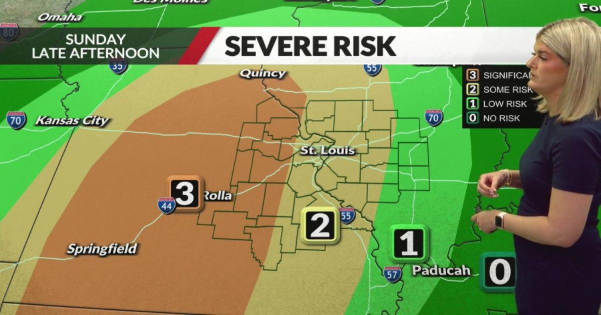
The initial threat for severe weather remains low, but conditions may worsen by Sunday afternoon as the atmosphere recovers and instability increases.
The morning rain is expected to move east by 10 a.m. Sunday, providing a brief period of dry weather before the atmosphere recharges. A line of storms is anticipated to affect the western regions by 4 p.m., reaching the metro area by 7 p.m., and continuing into southern Illinois thereafter.
St. Louis radar: See a map of current weather here
These storms could produce severe weather, including hail and damaging winds, depending on how unstable the airmass becomes.
Rainfall from the overnight system is not expected to be as heavy as the previous night, reducing the risk of flash flooding, although river levels will need monitoring. The active weather pattern is forecast to exit by 10 p.m. Sunday, with dry conditions and near-to-above normal temperatures expected for Monday and Tuesday.
A return to wet weather is anticipated from Wednesday through Friday, with increasing chances of precipitation.
Residents are advised to remain weather aware as conditions evolve, with the potential for severe weather impacting the region through Sunday evening.
All facts from this article were gathered by KTVI journalists. This article was converted into this format with assistance from artificial intelligence. It has been edited and approved by KTVI staff.
Copyright 2025 Nexstar Media, Inc. All rights reserved. This material may not be published, broadcast, rewritten, or redistributed.
For the latest news, weather, sports, and streaming video, head to FOX 2.