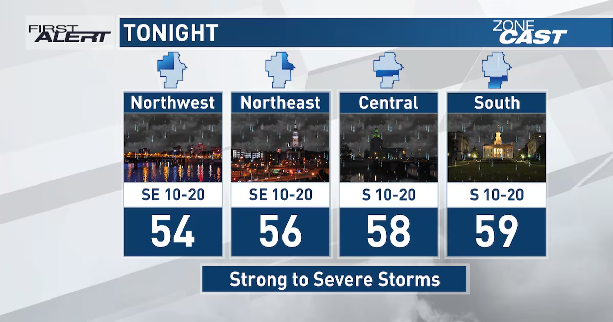
CEDAR RAPIDS, Iowa (KCRG) – Storms move into eastern Iowa tonight. Some of them could be strong to severe.
Your First Alert: Storms move in overnight, some strong to severe
Showers and storms will be moving in from the west tonight. Some of the storms moving into eastern Iowa have a history of producing damaging winds, large hail, and multiple tornadoes. As these storms approach eastern Iowa, however, they are expected to weaken. Large hail and some damaging wind gusts are possible overnight.

The latest scan from Pinpoint Doppler Radar. (KCRG)
Scattered showers and a few storms linger into Friday morning as lows tonight fall into the middle and upper 50s.
Mild and stormy tonight(KCRG First Alert Storm Team)
What to do when severe weather threatens
If a storm approaches your area, seek shelter indoors. If a warning is issued, get to the lowest floor of your home, away from windows. In the event of a tornado warning, put as many walls between you and the outside as possible, like in an interior closet or bathroom. A basement is best if you have one. Cover your head and neck with pillows or blankets, or a bike helmet if you have one. If you’re in a mobile home, abandon it for more substantial shelter. If caught outdoors, try to get to an indoor shelter. As a last resort, lay flat in a ditch while protecting your head and neck. Don’t seek shelter under bridges or overpasses.
It’s important to make sure to have multiple ways to receive warnings. A NOAA Weather Radio is a great tool in this case. Make sure it’s plugged in and turned on, ready to receive warnings, before you head to bed. We also recommend the KCRG-TV9 First Alert Weather App, which can give you customized alerts for your location. Of course, we’ll also provide updates on KCRG.com and KCRG-TV9 as conditions warrant.
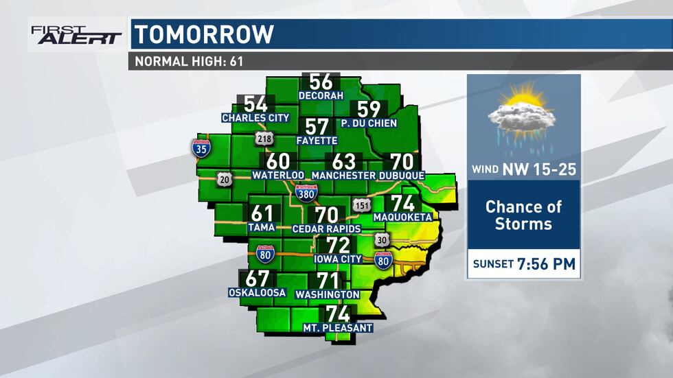
Your First Alert: Lingering storms, falling temperatures Friday
Scattered showers and a few rumbles of thunder linger on Friday. A cold front pushes through the area and will bring cooler air to the area as rain chances diminish through the afternoon and evening. Temperatures tomorrow will climb until the front passes by, then they will fall for the remainder of the afternoon. Highs tomorrow range from the 50s in our northwest counties to the 70s in our southeast. Lows fall into the upper 30s and low 40s Friday night.
Falling temperatures Friday afternoon(KCRG First Alert Storm Team)
Your First Alert: Staying active for Easter Weekend
We get a brief break from showers and storms on Saturday as highs climb into the upper 50s and low 60s under partly cloudy skies. Sunday brings a return of shower activity as highs climb into the mid 50s. You’ll be better off moving Easter activities and egg hunts inside. Lows Sunday night fall into the low to mid 40s as shower chances continue. Next week is warmer, with highs in the 60s and 70s and lows in the 40s and low 50s. However, we keep off and on rain chances throughout the week as storm systems pass by eastern Iowa.
We’re monitoring the chance for strong to severe storms and a rainy Easter.
Copyright 2025 KCRG. All rights reserved.