A severe weather outbreak is possible on Monday, April 28, forecasters warned, the first day of what could be a multiple-day siege of stormy weather over the central, eastern and southern states.
“The atmosphere will be very conducive for severe weather,” the National Weather Service said.
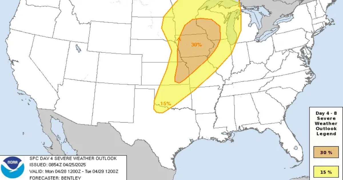
A “widespread, significant” threat will develop April 28, especially in the afternoon and evening, according to an online forecast from Weather.com meteorologist Chris Dolce.
Strong tornadoes, large hail, and high winds are all possible dangers.
Cold front to trigger severe storms
AccuWeather said the storms are likely to organize along an advancing cold front from the eastern part of the Dakotas, Minnesota and western Wisconsin to west-central Texas. Iowa and southern Minnesota could be in the crosshairs of a moderate risk of severe weather that includes tornadoes.
Cities like Minneapolis, Des Moines, and Kansas City are all in the line of fire, Dolce said.
“Tornadoes, some possibly strong (EF2 or greater damage), as well as large hail and damaging winds, are all possible threats,” he said.
EF2 tornadoes have wind speeds of up to 135 mph, the weather service said.
Threat continues Tuesday and Wednesday
On Tuesday, April 29, all modes of severe weather – hail, high winds and a few tornadoes – are possible as the front advances eastward from the Plains to the Great Lakes and the Ohio and Mississippi valleys, said AccuWeather meteorologist Alex Sosnowski in an online forecast.
Cities at greatest risk April 29 include Dallas-Fort Worth, St. Louis, Indianapolis, Cincinnati and Pittsburgh, Dolce said, “The potential for flash flooding from heavy rain is also in play,” he said.
By Wednesday, April 30, AccuWeather’s Sosnowski said the potential for severe thunderstorms will extend to parts of the Northeast and the lower portion of the Mississippi Valley.