(WJW) – Windy, warm, and very humid on Tuesday. Temperatures will climb to between 75° and 80°. Expect the sky to cloud over with developing rain showers and potential for strong storms.

Here’s what we are tracking: A brief morning shower with clouds increasing. An early afternoon storm is expected to pop up. Sunny breaks, then a line of storms will develop late Tuesday afternoon, early evening. With the warm, humid air, some of the storms that develop could be strong and produce gusty winds, hail, and heavy rain.

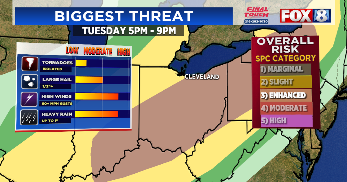
The best timing of the storms on Tuesday will be between 5 p.m. and 9 p.m., impacting the evening commute.

Here’s a look at futurecast radar:

Wednesday will be a much cooler and less humid day. Highs on will range from the upper 50s along the lakeshore to near 70° for our far southern communities.


Wednesday, scattered showers/storms return as early as Wednesday night. On/off showers with some sun and higher humidity continue Thursday and into Friday morning.

The first weekend of May will be cooler, with highs in the 50s and 60s.

After a cooler weekend, temperatures stay consistently mild most of next week (60s).

Here’s the latest 8-Day Forecast:

Stay up-to-date by downloading the FOX 8 apps, including the new FOX 8 CLE+ streaming app available for free on Amazon Fire, Roku, and Apple TV.
Copyright 2025 Nexstar Media Inc. All rights reserved. This material may not be published, broadcast, rewritten, or redistributed.