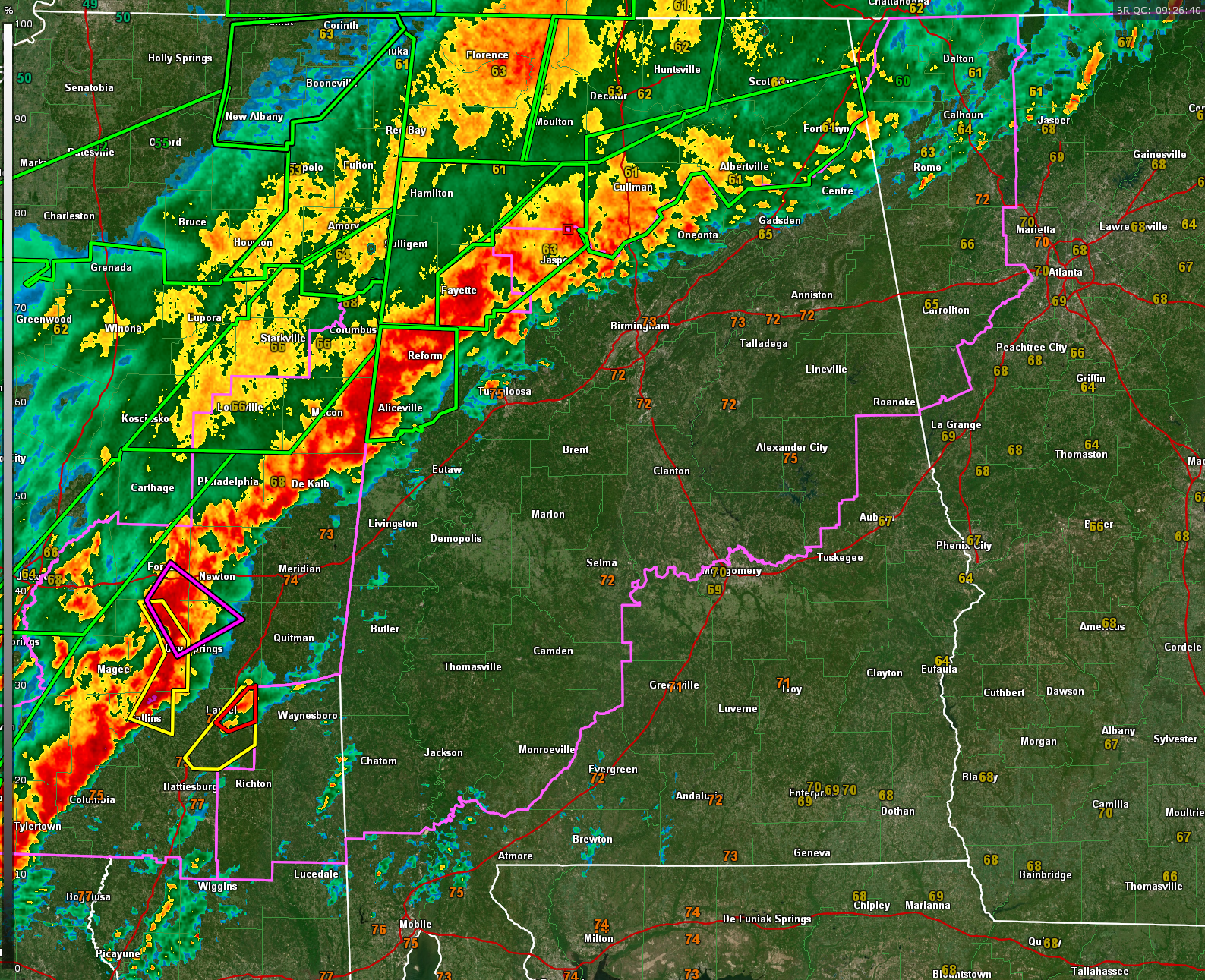
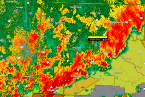
As of early this morning, most warnings in Alabama are now flash flood warnings, with widespread flooding across the northern third of the state. A new flash flood warning was just issued for Pickens County in West Alabama.
Active flooding is being reported in Columbus MS.
One tornado warning remains in effect for southeastern Macon County, but that storm has weakened. The most concerning tornadic activity is just across the Mississippi line, where a confirmed tornado warning is ongoing for parts of Smith, Jasper, Scott, and Newton counties. A large MCS has developed south of I-20 near Meridian, producing a severe thunderstorm warning and a 62 mph gust at the Naval Air Station there. Another severe thunderstorm warning was just issued for Jones County near Laurel and it has been augmented by a new tornado warning as well. This storm will head toward Choctaw and perhaps Sumter counties in West Central Alabama.
Storms over northeastern Alabama have weakened significantly, but strong cells continue from Blount through Cullman into Walker, Fayette, southern Lamar, and Pickens counties, extending back into Mississippi. Flash flooding remains a serious concern with repeated rounds of heavy rain training over the same areas.
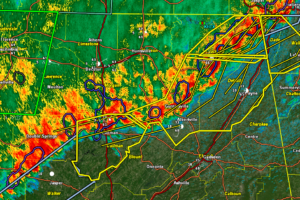
According to the Storm Prediction Center, storms along the slow-moving outflow boundary will continue to spread into central Alabama from southeastern Mississippi over the next few hours. Circulations embedded within the line, and possibly some discrete cells ahead of it, will continue to pose a threat of brief tornadoes and damaging winds through 6 to 7 am. This activity is feeding off a narrow corridor of moisture and instability, with enough wind shear to maintain some tornado potential.
A tornado watch remains in effect for much of central Alabama until 10 am, and a flash flood watch remains in effect for all of central Alabama through Monday evening. Conditions will remain unsettled through the morning, so continue to monitor for new warnings.
Category: Alabama’s Weather, ALL POSTS, Severe Weather, Social Media
Page 2
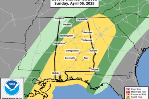 A powerful storm system brings severe weather and flooding to Alabama today, followed by a sharp cooldown and the potential for frost by midweek.
 Flash flooding is widespread across northern Alabama, and a line of storms moving in from Mississippi will continue to pose a threat of damaging winds and brief tornadoes through the morning.
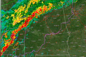
 Flash flood warnings remain in effect early this morning for parts of north and central Alabama, where multiple rounds of heavy rain have led to dangerous flooding in low-lying and poor drainage areas.
 The tornado watch goes until 10 am.
 Severe thunderstorms were located along a line extending from near Henagar to near Geraldine to near Strawberry, moving east at 20 mph.
 Doppler radar indicated thunderstorms producing heavy rain across the warned area. Between 1.5 and 2.5 inches of rain have fallen. Additional rainfall amounts of 1 to 2 inches are possible in the warned area. Flash flooding is ongoing or expected to begin shortly.
 This dangerous storm will be near…Sylvania, Powell, and Rainsville around 205 AM CDT. Fort Payne around 210 AM CDT.
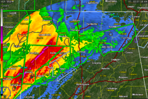
 Dangerous storm coming out of Pickens County, but the radar data is messy and doesn’t seem to indicate that there is a tornado there.
 severe thunderstorms were located along a line extending from near Trenton to near Ider to near Pisgah, moving east at 50 mph.
 Severe thunderstorms were located along a line extending from 8 miles west of Arab to near Moreland, moving east at 25 mph.
 Folks from Macedonia to Ethelsville, all along US-82 then up to Liberty, Shaw, and Bethlehem need to be in tehir tornado safe spots now!
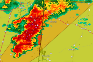 A severe storm with rotation aloft is moving into Pickens County, prompting a warning through 2:15 AM as we watch closely for potential tornado development.
 The most dangerous storm is near New Hope in southern Madison County moving east southeast into Marshall County approaching Lake Guntersville.
 Two rotations over eastern Mississippi and western Alabama have us concerned at this hour.
